
Blog Post: The Science of Snow Cone
Big Sur Waterfall Project: Part I, Part II, Part III
This Page Last Updated April 16, 2015 (but waterfall project updated June 6, 2020)
The Big Sur region is an adventure running playground. The Ventana Wilderness, Silver Peak Wilderness and a handful of state parks form a network of protected public land over the northern half of the Santa Lucia Mountain Range that is one of the greatest coastal wilderness regions anywhere. The steep degree of relief from the ocean to the mountaintops is unmatched in the contiguous United States providing dramatic vistas throughout the coast. Perhaps one of the most magical Big Sur experiences is a clear day when the ridgetop views include a backdrop of the deep blue Pacific Ocean transitioning to turquoise near the coastline. However, a foggy day along the coast can be equally fascinating as the marine layer interacts with the terrain. In the interior of the wilderness, deep, shady canyons slice through the Santa Lucia Mountains and are filled with ancient redwoods, waterfalls, gorges and mystique. The higher reaches of the wilderness are characterized by rugged, rocky summits with rare groves of the stately Santa Lucia Fir, endemic to these mountains and one of my favorite tree species. Iconic spots like Bixby Bridge and McWay Falls draw millions of visitors to the Big Sur Coast, but with the exception of Sykes Hot Springs, a minuscule fraction travel far from the highway leaving a vast wilderness where solitude, intrigue, and a substantial amount of brush can be found.


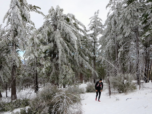
 Adventuring in Big Sur and the Ventana Wilderness is certainly possible in the summer months if travel is restricted to the immediate coast and the cool canyons, but the higher terrain can be extremely hot resulting in copious sweat, biting black flies, and active rattlesnakes. Therefore, the ideal time for exploration is from late fall through late spring when the air temperature is cooler, bugs are minimal, and the snakes are dormant. Furthermore, the winter months can provide a special treat when the occasional storm drops several inches of snow on the summits providing a unique experience of coastal views combined with snow. These same storms bring downpours to the lower elevations, enlivening the vegetation and numerous waterfalls. I have done several adventures in Big Sur over the years, but it took until last winter for me to become captivated by the phenomenal beauty of this region and gain a desire to explore the land in-depth. The result has been a bevy of awesome explorations and much inspiration for future adventures. This post compiles all of my Big Sur outings separated by sub-region categories that I came up with that made sense to me, generally organized from north to south. Most of the trips link to a dedicated blog post with many photos and a description of the adventure, but some only link to photo albums. This post also includes an array of some of my favorite photos from the region. The best resource to use when planning your adventure is Big Sur Trail Map, which includes wilderness trail conditions, donwloadable topographic trail maps and a route metrics generator. The Ventana Wliderness Aliance Forum also includes trip reports where the most recent conditions can be found. Feel free to ask me for any additional tips or information. As there is still a lot for me to explore in Big Sur I will continue to update this post.

North Big Sur Coast:
- Doud Peak & Rocky Ridge (April 13, 2013) – Garrapata State Park
- Doud Peak & Rocky Ridge (May 11, 2013) – Garrapata State Park
- Sierra Hill at Brazil Ranch (December 22, 2013)
- Soberanes Loop (December 21, 2014)
- Soberanes Loop (January 2, 2015)


North Interior Ventana; the Carmel River:
- Carmel River Point-to-Point (October 2009)
- Carmel River-Ventana Double Cone Loop (January 10, 2015)
- Ventana (single) Cone Adventure (January 17, 2015)
- Carmel River Falls & Gorge (February 1, 2015)
- Ventana Triple Crown (April 4, 2015)
- Church Creek and Pine Valley (April 11, 2015)
- Other: Miller Canyon


Cabezo-Molera, Coast to Ridge:
- Post Summit & East Molera Ridge (April 14, 2013)
- Andrew Molera (October 13, 2013)
- Cabezo-Molera Loop (January 4, 2014)
- Cabezo-Molera Loop (February 23, 2014)
- East Molera Ridge & Post Summit (April 20, 2014)


Little Sur featuring Pico Blanco, Prince of the Ventana:
- Pico Blanco via Little Sur (May 12, 2013)
- Circular Pools (January 26, 2014)
- Pico Blanco-Little Sur Loop (February 16, 2014)
- Pico Blanco’s North Ridge (November 28, 2014)
- Circular Pools (February 16, 2015)


Ventana Double Cone, Queen of the Ventana:
- Ventana Double Cone (December 24, 2013)
- La Ventana Loop (January 15, 2014)
- Kandlbinder & Ventana Double Cone via the Drain (April 13, 2014)
- Big Sur Station to Bottcher’s Gap via Ventana Double Cone (May 4, 2014)
- The Drain and Ventana Spires (March 7, 2015)
- Big Sur Station to Bottcher’s Gap via Ventana Falls, The Window and Kandlbinder (March 14, 2015)
- Ventana Triple Crown (April 4, 2015)


Big Sur River, Wild & Scenic:
- Sykes Hot Springs (November 2009)
- Into the Wild on the Big Sur Trail (January 11, 2014)
- Redwood Creek & Sykes Hot Springs (July 27, 2014)
- Mocho Loop featuring Mocho Falls (January 24, 2015)
- Pick Creek Loop (February 14, 2015)


Coast Ridge including Marble Peak and Mining Ridge:
- Limekiln to Big Sur via the Coast Ridge (December 28, 2013)
- Boronda and Marble Peak (April 5, 2014)
- Coast Ridge: Stone to Boronda (December 28, 2014)
- Coast Ridge and Marble Peak (March 28, 2015)


Arroyo Seco, the Gorge:
- Marble Peak 50k+ (December 6, 2014): A trans-Ventana route from the Arroyo Seco Gorge to Mable Peak on Coast Ridge
- Last Chance Falls, Jeff Falls and Santa Lucia Creek Gorge (February 10, 2015)


Memorial Park featuring Junipero Serra Peak – Grandfather of the Ventana:
- Junipero Serra Peak (December 8, 2013): The highest point in the Santa Lucia Mountains at 5,857 ft
- Santa Lucia Three Peaks (January 25, 2014): A classic route that includes the summits of three major peaks in the Ventana Wilderness – Cone Peak, Twin Peak and Junipero Serra Peak
- Cone Peak’s North Ridge & Lost Valley (March 8, 2014)


Central Big Sur Coast, Big Views:
- Boronda/De Angulo Loop (December 21, 2013)
- Partington Cove to McWay Falls (December 22, 2013) – Julia Pfieffer Burns State Park
- Partington to McWay, Julia Pfieffer Burns (March 15, 2014) – Julia Pfieffer Burns State Park
- Big Creek Reserve (May 10, 2014) – Open to the public one day each year!
- Prewitt & Boronda Wildflowers (May 11, 2014) – One of the greatest wildflower displays
- Boronda Turkey Trot (November 27, 2914)
- Big Sur Condor Loop (December 13, 2015)
- Ewoldsen & Alta Vista (December 27, 2015)
- El Condor Pasa (April 12, 2015)


Cone Peak, King of Big Sur:
- Cone Peak via Vicente Flat (January 10, 2010)
- Cone Peak via Vicente Flat (January 15, 2011)
- Cone Peak via Stone Ridge Direct (April 20, 2013)
- Cone Peak Marathon (November 3, 2013)
- Cone Peak via Stone Ridge and North Coast Trail (December 15, 2013)
- Stone Ridge Direct (February 1, 2014)
- Stone Ridge Direct Loop & Cone Peak (April 19, 2014)
- Cone Peak via Vicente Flat FKT & Stone Ridge Descent (April 26, 2014)
- New Year’s Day Stone Ridge Loop (January 1, 2015)
- Stone & Cone (January 19, 2015)
- Cone Peak Climbs (January 31, 2015)
- Sea to Sky Vista (April 12, 2015)


South Coast – Pacific Valley:
- Prewitt Ridge (December 29, 2013)
- Shouey-Plaskett Loop (February 1, 2014)
- Shouey-Plaskett Loop (February 15, 2014)
- Kirk Creek Ridge (February 15, 2014)
- Prewitt Ridge & South Coast Ridge (April 6, 2014)


South Coast – Silver Peak Wilderness featuring Silver Peak, Princess of Big Sur, and Mount Mars, the Duke of the South Coast:
- Buckeye Loop (January 5, 2014)
- Mount Mars (January 5, 2014)
- South Coast Adventure (February 24, 2014)
- Silver Peak Wilderness Loop, Lion Peak and Mt. Mars (March 16, 2014)
- Dutra Loop and Soda Peak (November 23, 2014)
- Dutra Loop (January 3, 2015)
- Dutra Loop and Upper Salmon Creek Falls (March 29, 2015)


Après-Adventure:
- Point Lobos: Located at the northern end of the Big Sur Coast, Point Lobos State Reserve is very popular, especially on sunny weekends. The park features numerous rocky promontories, picturesque coves and a pretty Monterey pine forest. There are many trails in the reserve that are good for a shorter run or a post-adventure stroll.
- Bixby Bridge: An essential photograph spot for tourists, this famous historic bridge is indeed very photogenic
- Soberanes Point: Rugged scenery at Garrapata State Park
- Point Sur: Historic site
- Pfieffer Beach – purple sand from manganese garnet deposits
- McWay Falls: Iconic Big Sur location and another must-photo location for tourists, located just off Hwy 1 at Julia Pfieffer Burns State Park
- Pacific Valley Bluff: Spectacular sea stacks with Cone Peak & Stone Ridge as a backdrop.
- Sand Dollar Beach: Largest beach in Big Sur with beautiful sand and scenery


Great set of Hikes !
I recommend the route from Bottchers to Palo Corona Park entrance (near carmel river mouth). For that route ascend Mt. Carmel from Bottchers, then follow the ridgeline toward twin peak, then just keep going north along the ridge until you hit hwy 1 at Palo Corona Park entrance. The vast majority of the route is along jeep roads. With your skills a day-trip from Big Sur to VDC, over Mt. Carmel and out Palo Corona seems like a possibility.
Sweet! Thanks for sharing.
Wow, you picture looks so amazing. Would you mind letting me know which trail is the first picture and what time of year to have the purple flower bloom when you were taking?
This is so AWESOME!!! Last Winter a buddy and I did Arroyo Seco to the coast in 3 day backpack. Marble Peak trail to Church Creek trail to Pine Ridge Trail to Terrace Creek to Big Sur Station. I bet you could run it in 1 day.
Don’t forget the poison oak….
(And thanks for the very nice summaries!)