
The South Big Sur Coast stretches from Pacific Valley to Ragged Point. Due to its remote location 1.5+ hours from Monterey Bay, it is the least visited portion of the Big Sur coast, but it is well worth the extra time. The centerpiece of this region is the Silver Peak Wilderness, established in 1992 and containing 31,555 acres, containing a network of amazing trails including the Cruikshank Trail, the Salmon Creek Trail and the Buckeye Trail. Also included in the wilderness is Mount Mars, which is one of the most spectacular and impressive grassy ridges in all of Big Sur. In fact, the incredibly steep west ridge of Mount Mars rises over 2,600 ft in a little over 1.25 miles as the crow flies from the ocean! The Buckeye Trail is arguably the most scenic coastal trail in all of Big Sur with outstanding vistas and enjoyable technical single track. One of the best ways to enjoy the South Coast is via a point-to-point such as the South Coast Adventure route described here.

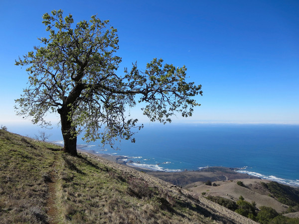
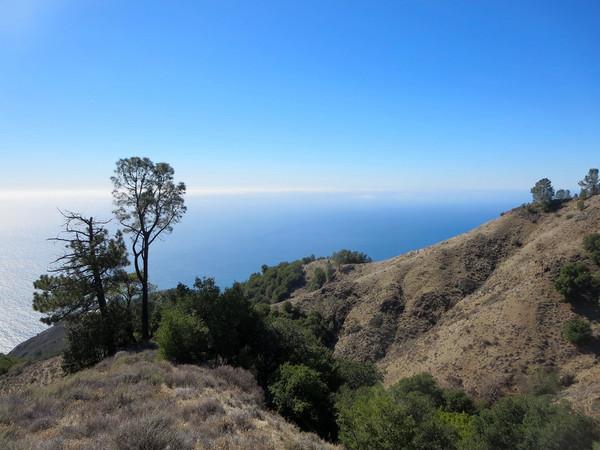
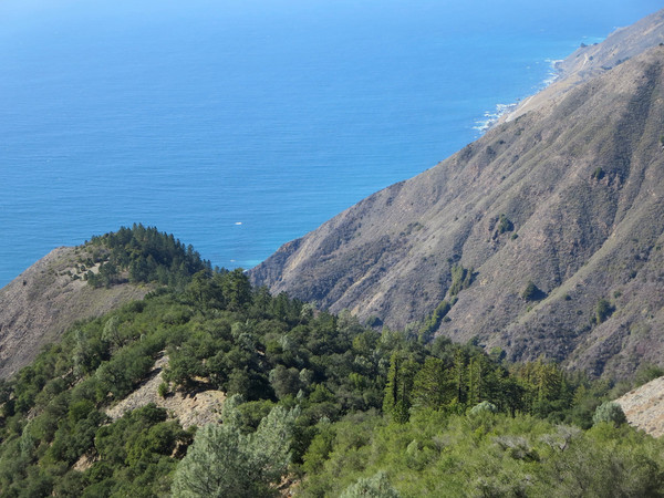
 The South Coast Adventure route starts at Williams Ranch which is a working cattle ranch at the southern tip of the Big Sur coast near Ragged Point. A steep ascent up the grassy slopes leads up toward Bald Top and County Line Ridge with impressive views to the Piedras Blancas coastal plain. Once on County Line Ridge a dirt ranch road leads along the top of the ridge with excellent vistas of the deep blue Pacific on one side and interior views on the other. The ridge is largely grassy meadows with clumps of heritage oaks. As you move north along the ridge, there are more pine trees, including gray pines, Ponderosa pines, and Coulter pines. At the junction with County Line dirt road, stay on the ridge crest and follow the Mount Mars traverse use path 0.6 miles to the summit of Mount Mars. The first part of the path climbs steeply through pine and oak forest and then chaparral to a pair of sub-summits before making the final climb in low manzanita to Mount Mars. From the summit, take a vegetation tunnel that was cut through the tall chaparral down to the grassy west ridge. The view as you emerge from the vegetation tunnel is simply stunning with Salmon Cone and the deep blue Pacific Ocean 2,500 ft below. On the left is Piedras Blancas with the lighthouse visible on clear days and on the right is the rugged Silver Peak. As you head down the beautiful grassy ridge, it is difficult to keep from gazing at the amazing view, but use caution as the slope is extremely steep with loose rocks. About two-thirds of the way down is lovely Kozy Kove Meadows, a fairly flat spot that is also the turnoff for the use path that leads down to the Salmon Creek Trail and beautiful Salmon Falls, which is set amid large boulders and bay trees.
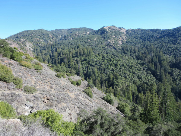
 At the Salmon Creek Trailhead run on Hwy 1 for a couple hundred meters to reach the Buckeye Trailhead. The initial climb on Buckeye Trail is quite steep and exposed so it is often very hot. About 1 mile in, the Soda Springs Trail branches off down to another trailhead along Hwy 1 while the Buckeye Trail commences another climb through chaparral and oak woodland for 2.5 miles to Buckeye Camp and Buckeye Springs. The coastal vistas along this stretch are magnificent. Buckeye Camp is located in a peaceful meadow with a colossal oak tree, some pines, and even a few mature eucalyptus that were planted here decades ago when (I’m assuming) a homestead existed in this meadow. A spring near the camp provides refreshing cold water. Buckeye Camp would certainly make for a great nap spot! Beyond Buckeye Camp, the trail descends to Redwood Gulch Creek before making a final ascent to Buckeye Vista, Pt. 2,318, arguably the best view on the entire trail. After Buckeye Vista, the trail enters pine forest as it switchbacks down the hill to Cruikshank Camp. For this route, continue through Upper Cruikshank camp and descend to redwood-filled Villa Creek remaining on the Buckeye Trail. The Buckeye Trail then traverses the ridge on the north side of Villa Creek canyon with excellent views of Villa Creek canyon and then rounds a corner into the Alder Creek drainage which contains alder and Douglas Fir forest, a fascinating contrast to the redwoods in Villa Creek. At Alder Camp take the Alder Creek Road up to San Martin Top Ridge where there is a four way junction. Continue straight onto the Willow Creek Road which leads down through the largest Douglas fir forest on the central coast to the Highway near Cape San Martin. There are some nice views in the bottom portion of Willow Creek road when it emerges from the forest. An excellent 36 mile point-to-point route that I look forward to doing in the future would be to turn right at the four way junction on San Martin Top ridge and connect into South Coast Ridge Road which can be taken all the way to Prewitt Ridge for a spectacular descent into Pacific Valley. Stay tuned for posts on a couple more routes in this gorgeous section of the Big Sur Coast! Strava track for this route here.


Kind of random question, but I figure it goes along with I was the Big Sur Coast. I was wondering if you have ever run the Big Sur Trail 1/2 or full marathon? If so, could you please let me know your opinion of it? The map says it runs up the Old Coast Rd. from Andrew Molera State Park. Is this really a dirt trail? thank you for your help.