
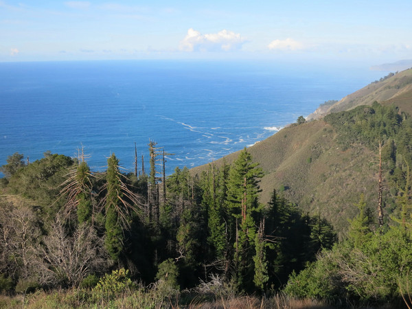
The Big Sur condor loop is an awesome coastal loop at the heart of the Big Sur coast. The route starts with a direct route up Anderson Peak (aka “Anderson Direct”) from McWay Falls, gaining 4,000 feet in less than 3 miles by following an old firebreak/underground utilities line up the prominent ridge between McWay Canyon and Anderson Canyon. Anderson Direct is to Anderson Peak what Stone Ridge is to Cone Peak; an extremely steep ridge climb with stunning coastal views. Unlike Stone Ridge, Anderson Direct is not grassy and the upper two-thirds are essentially a continuous blowdown with literally thousands of burnt snags over the route from the 2008 Basin Complex fires. There are also some patches of festering poison oak to wade through, but the good news is the brush is relatively light. It’s an arduous route, but it’s easily the most efficient way to reach Anderson Peak on foot and remarkably scenic with enormous views up and down the Big Sur coast . GPS data here.

 About 1 mile up the ridge we passed right next to the home of the local condor population. They were resting on the crowns of the redwoods in the early morning sunshine, presumably drying off from the recent rains. The condors were the closest I have ever seen so I could see their features in detail. The condor has a very prehistoric look. An extensive reintroduction program has allowed the majestic California condor to return to its native habitat soaring over the Santa Lucia Mountains. In 1987, the California condor was eradicated from the wild due to poaching, lead poisoning and habitat destruction. The remaining 22 birds were taken into captivity to prevent species extinction. Starting in 1992, the birds were reintroduced into the wild and Big Sur was one of the earliest release sites. Currently there are an estimated 237 free-flying condors in California, many of which still reside in Big Sur but the population’s range has expanded to Pinnacles National Park, Ventura County and the Transverse Ranges. On this day we were grateful to see 9 of these magnificent birds. Later on our ascent the condors took off and flew as a group showcasing there remarkable wing span that is up to 9.5 feet! The wings are so big that when the bird flies above enough air is pushed aside that it makes a sound like a kite. At one point we saw all 9 condors circling above us. It seemed as if the condors followed us throughout our journey as we continued to see these majestic birds from Coast Ridge Road and on the descent of the DeAngulo Trail, hence the name I gave this loop. While there is no guarantee of seeing condors in this area, let alone 9 at the same time, this was not the first time I’ve seen condors soaring above Torre Canyon, Partington Canyon and McWay Canyon.
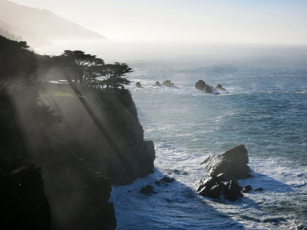
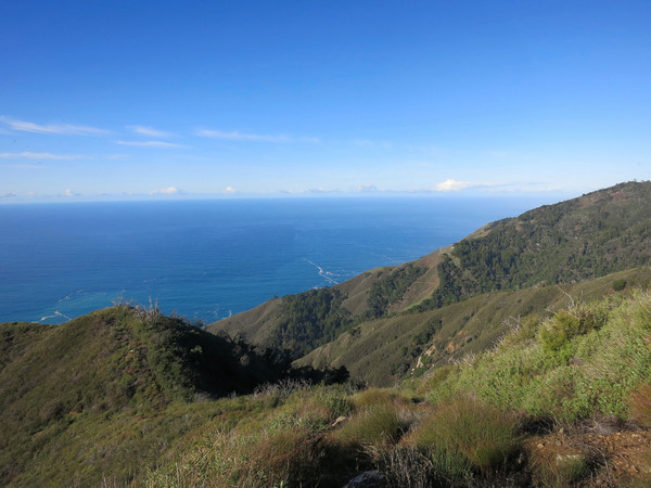 From Anderson Peak, we took the Coast Ridge Road for about 4 miles with a continuation of coastal vistas and also great views of the interior Ventana including the South Fork Big Sur River drainage, Ventana Double Cone, Black Cone and Junipero Serra. We then descended the DeAngulo Trail. Overall, the DeAngulo trail was in decent condition, and now even better since we cleared out branch debris and Brian did substantial pruning with his loppers. There were excellent views to Boronda Ridge and looking north up the coast. At the bottom of DeAngulo, we ran along Hwy 1 for one mile to connect into the Julia Pfieffer Burns Trail network including the Tanbark Trail, Waters Trail and Ewoldsen Trail, ultimately depositing us at McWay Falls to complete the loop. The highlight of this section was beautiful Partington Canyon, lush as ever with nice flow through Partingon Creek’s cascades. While McWay Falls is definitely touristy, it’s popular for a reason and a great way to finish the loop with afternoon light on the falls. GPS data here.


One CommentAdd yours