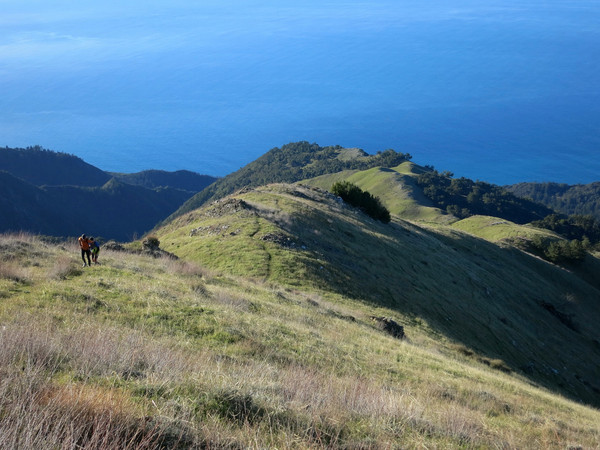
The Coast Ridge point-to-point was one of my favorite routes of the 2013-2014 Ventana season. I love point-to-points since I feel they are the best way to maximize viewing as much terrain as possible. The second annual Coast Ridge route was largely the same as the first with a few important variations that enhanced the route including (i) taking Stone Ridge Direct to Cone Peak, (ii) descending Cone Peak via its North Ridge, (iii) making a small detour to fill water at pretty Cooks Spring, and (iv) descending Boronda Ridge instead of continuing on Coast Ridge Road to Ventana Inn. The net result of these changes was about 6 fewer miles but we gained a summit of Cone Peak, more ridge walking, more single track and more elevation gain. Overall, the route was still many miles of amazing and constantly changing scenery for its entire 33 mile length. This aesthetic route is a masterpiece and one of the “super” classics of Big Sur and the Ventana Wilderness. The route essentially parallels the coast from south to north and is mostly right on the crest of Coast Ridge. As you might expect from a ridge of this prominence, there are wide vistas in all directions for virtually the entire route. On the west side of the ridge, the Pacific Ocean and Big Sur Coast are ever present, with views into some of the most wild and rugged drainage basins along the entire coast, including the forks of Devils Canyon and Big Creek. On the east side of the ridge are vistas into the remote interior Ventana Wilderness including the Lost Valley, Junipero Serra and the South Fork Big Sur River. GPS route here. Full photo album here. 


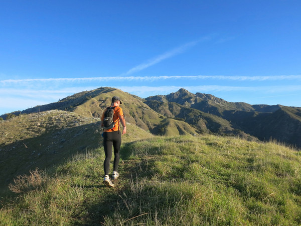
 Most of the elevation gain is accomplished within the first 6.5 miles and after one last climb up to Anderson Peak, a running-friendly dirt road provides a net gradual downhill for 7 miles to Timber Top and then a beautiful tour down single track on Boronda Ridge in evening light. The middle section on the North Coast Ridge Trail is the most remote and has some brushy sections and a few small blowdowns, but no major bushwhack and route finding is straightforward. The route beings with a steep climb out of the redwoods in Limekiln Canyon onto lower Stone Ridge. At the intersection with the Stone Ridge Trail, instead of taking the trail into the West Fork Limekiln drainage we continued up Stone Ridge direct to Twin Peak enjoying the spectacular views from this prominent grassy ridge. From Twin Peak we traversed over to Cone Peak and descended Cone Peak’s North Ridge with excellent views of the South Fork Devils Canyon and also the San Antonio River Drainage. At the end of the North Ridge we joined with the North Coast Ridge Trail which has sublime views of the surrounding terrain. After an open area, the North Coast Ridge Trail enters a spectacular sugar pine forest with a nice smooth trail covered in pine needles. We made a small detour off the trail to Cooks Spring Camp and spring, set amid towering old growth sugar pines and a few incense cedars. Back on the North Coast Ridge Trail we exited the forest near Tin Can Camp, which possesses one of the best views of the entire route. To the west is the remote, rugged and trail-less Middle Fork Devils Canyon and to the east is the imposing massif of Junipero Serra Peak.


 Beyond Tin Can Camp, the North Coast Ridge Trail descends through one last stand of Sugar Pine and Coulter Pine forest before exiting into a largely chaparral landscape that was burned in the 2008 Basin Complex fire. The trail is easily followed, but contains areas of brush and downfall to negotiate. The firebreak and the trail are mostly in unison on the ridge ridge crest, however they sometimes diverge when the firebreak sticks to he crest religiously while the trail will traverse across the terrain (mostly on the west side) to avoid intermediary high points and unnecessary ups and downs. We mostly stayed to the trail except we took the firebreak over Mining Ridge. As the highest point between Ventana Double Cone and the Cone Peak area, Mining Ridge has a fantastic 360 panorama. The firebreak can be taken up and over Mining Ridge to rejoin the North Coast Ridge Trail near the junction with the Redondo Trail (which leads down into Memorial Park). The next section was one of the best ridge sections with excellent views to Ventana Double Cone, which appears noticeably closer at this point in the journey. Along this ridge we were happy to find water at the Coast Ridge Spring (aka Redondo Spring) as this spring’s location is miraculous considering the surrounding dry terrain. We also found water in a stream about a mile earlier that was not running last year but was flowing after the December rains.


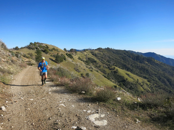
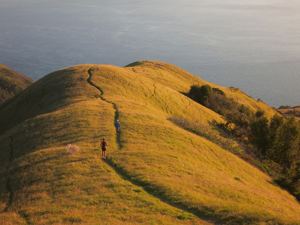
 The final portion of the North Coast Ridge Trail is becoming more overgrown. It was nice to see some pine trees survived the fire in this section as well as many new pine saplings emerging from the chaparral. The North Coast Ridge Trail ends at the Coast Ridge Road, which is a dirt road that would take us all the way to Boronda Ridge. While closed to public vehicular traffic, pedestrians have a right of way on this dirt road that is in reasonably good shape to allow access to a few homes and private properties along the way. We stuck to the road except for a small diversion to the rocky summit of Marble Peak which has another stupendous view of the surrounding region. The Coast Ridge Road skirts around Anderson Peak, which is fenced off government property, but after this point it’s mostly all downhill along the dirt road with amazing views throughout. At Timber Top we left the road and descended Boronda Ridge as the final chapter of the route. The views of the Big Sur coast from Timber Top and Boronda Ridge are truly spectacular and a fitting finish to a gorgeous point-to-point route. GPS route here. Full photo album here.


2 CommentsAdd yours