
Photo album here.
The Lost Coast is a spectacular meeting of land and ocean along the most undeveloped, remote and rugged stretch of coastline along the U.S. West Coast. I was eager to return here after amazing experiences in 2010 and 2012 (see 2010 TRs: King Range, Sinkyone; July 2012 album here). The northern portion of the Lost Coast is protected by the King Range National Conservation Area and 42,585 acres received Federal Wilderness designation on October 17, 2006. The southern portion is protected in Sinkyone Wilderness State Park, named after the Sinkyone Indians that lived on this part of the coast. The two sections are split by Shelter Cove, a small community of mainly vacation homes, but the parts are completely different in terms of their overall feel and experience. The northern section of the Lost Coast in the King Range NCA from the Mattole River to Black Sands Beach at Shelter Cove features a famous 24.5 mile beach walk with two-thirds of the distance spent on sand, gravel, and rock-hopping and the remaining third on trails just above the beach on the bluffs.
 Lesser known than the beach walk is the interior of the King Range NCA, which features a rugged subrange of the coastal mountains that reach just above 4,000 feet at King Peak. On my first two visits to the Lost Coast I did the beach walk in the King Range NCA, but on this trip I decided to explore the interior and designed a 50 mile loop that includes virtually all of the highlights of the beach portion along with with most of the highlights of the interior mountains including the Kings Crest and Cooskie Trails. The “King Range 50” is a phenomenal route that showcases the immense beauty of the King Range NCA, both the spectacular Lost Coast and the rugged interior mountains. It’s an aesthetic and convenient way to see a lot of amazing scenery without having to organize a care shuttle. The loop is a challenging route with over 11,000 feet of elevation gain, virtually all of it coming in the last 26 miles. However, the first 24 miles are no cake-walk either with a steep 3,200 ft descent down the Buck Creek Trail followed by nearly 20 miles along the beach on a sometimes arduous surface of talus or gravel. Careful planning must also take into consideration the two sections of beach that are impassable at high tide (a 4 mile section and a 4.5 mile section). Impassable at high tide is an accurate statement as the waves crash right into the cliffs at high tide making travel impossible. Being stranded part of the way through one of these sections would be very dangerous. GPS route here.
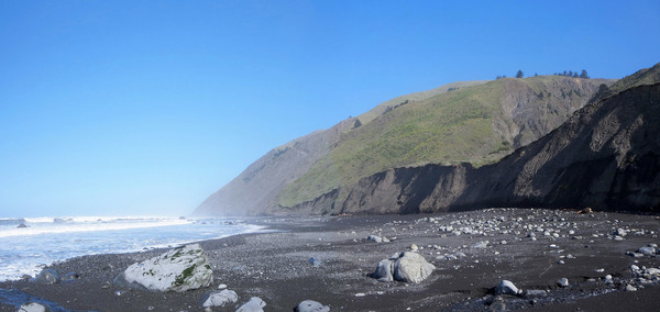
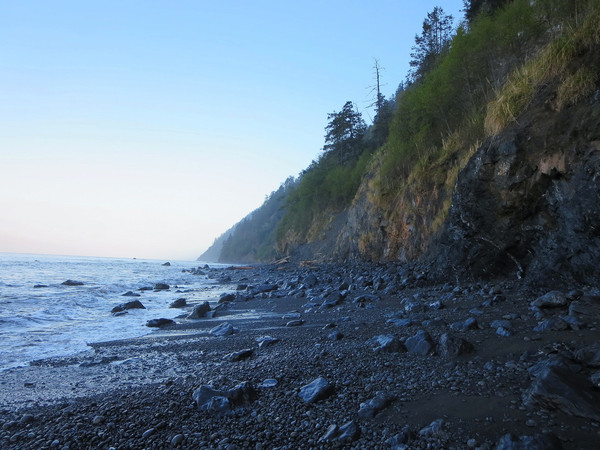
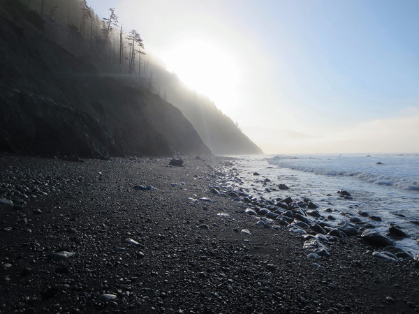
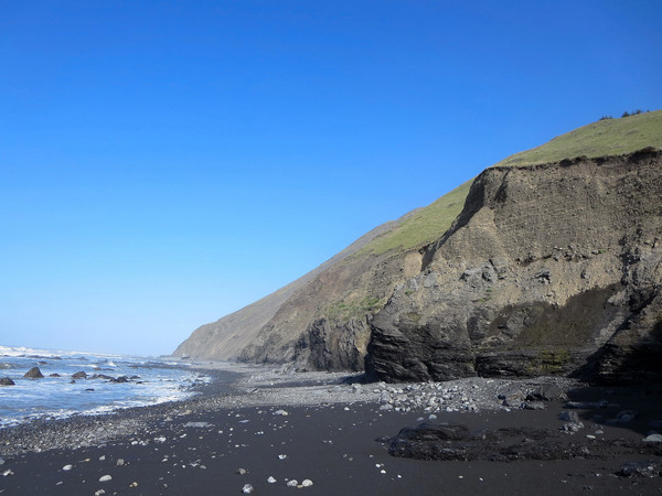
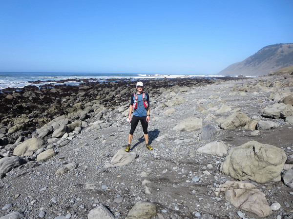
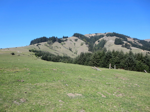
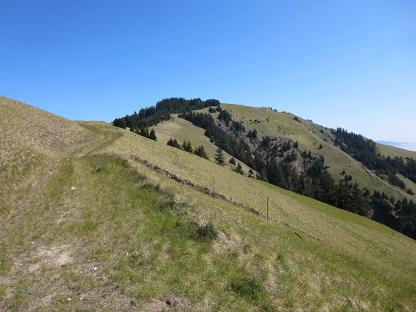
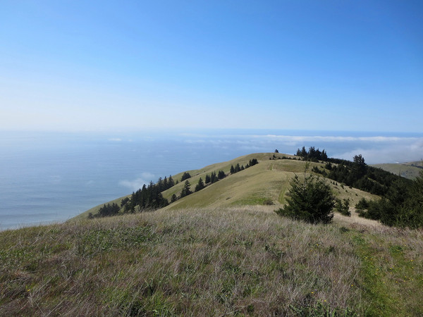
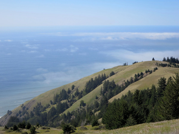
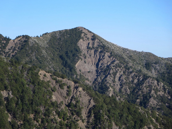
 The route beings with a steep descent down the Buck Creek Trail to Buck Creek camp along the coast. The upper portion of the trail features sweeping views to Shelter Cove and south to the Sinkyone portion of the Lost Coast. Towards the bottom the trail enters a lush forest with ferns covering the ground. Emerging on the coast, I began walking north on sand and rocks toward Miller Flat and Big Flat (this section is impassable in high tide). The coastal section was as beautiful as I had remembered from my previous visits. Continuing north past Spanish Flat, the beach walk enters another rocky and sandy section that is impassable at high tide. The geology of this portion is fascinating with cliffs of conglomerate and plate rocks coming right to the coast. The final section of my journey north along the coast featured Seal rock and Punta Gorda Lighthouse. Shortly after the lighthouse turn uphill on the Cooskie Trail, which climbs moderately steeply. The grassy slopes feature outstanding views of Punta Gorda to Cape Mendocino. The Cooskie Trail then enters a dense Douglas fir forest where directional arrows placed by the BLM are essential. This area sees little foot traffic and it would otherwise be easy to wander astray. The Cooskie Trail emerges from the dense forest into a meadow area known as “The HJ” with more excellent views of the northern part of the Lost Coast. The grassy meadows culminate at the summit of Gorda 2, with a jaw-dropping view of the Cooskie drainage on one side and the northern Lost Coast on the other. After a steep descent off Gorda 2, the Cooskie Trail passes a cattle area. The cow paths and other trails increase the route finding challenge as one descends to Cooskie Creek. Above, Cooskie Creek, the trail climbs through a lush glen with heritage oaks and big leaf maples. The trail then emerges onto meadows once more on Lake Ridge with excellent vistas back towards Gorda 2 and the coast, perhaps my favorite view of the entire loop. The Cooskie Trail finally reaches the junction with Spanish Ridge and from there it’s a short distance to the Spanish Ridge Trailhead. From the trailhead, it’s a run along the Telegraph gravel road to the North Slide Trialhead where the King Crest Trail begins. The King Crest Trail is an awesome stretch of singletrack with a healthy does of steep climbs and steep views. The conglomerate rock faces along the King Crest are fascinating. King Peak, the highest point in the region, is reached nearly 44 miles into the loop. It’s a phenomenal viewpoint with the chiseled canyons of Big Creek and Big Flat Creek thousands of feet below. After King Peak it’s mostly downhill although there was a surprising amount of downfall and brush in the first few miles to slow things down. The last couple miles to Saddle Mountain Trialhead are along an old road.


Incredible. Love it.
Very nice route, Leor. Great photos too. I’ve hiked about half of that, but going counterclockwise from Saddle Mtn trailhead. I have a few photos from some of those very spots. I remember coming up the Buck Creek trail…. It’s a fairly steep section there. That trailhead takes some effort to get to in itself, my truck nearly died back there… dodged a bullet luckily!
We just did almost this loop as a 3 day backpacking trip, with the difference of starting from Black sand beach trailhead and leaving the coast at Cooksie spur, not going all the way to Punta Gorda. Beautiful trip.
Great photos and information! We couldn’t find a shuttle, and therefore we did an out and back from Mattole to Spanish Ridge and took Cooskie Creek to Spanish Ridge trail above the LCT and returned on the beach. It was steep and beautiful! Felt very remote and untraveled. Excellent views!