
If Cone Peak is the King of the Big Sur Coast and Ventana Double Cone is the Queen of the Ventana Wilderness, then Pico Blanco is the Prince of the Little Sur. The mountain rises steeply between deep, redwood filled canyons which contain the two major forks of the Little Sur River. Pico assumes a regal position above East Molera Ridge and its coastal plain with phenomenal views of the entire Little Sur drainage and the rugged ridge from Kandlbinder to Ventana Double Cone. While Pico Blanco has relatively modest altitude at 3,709 ft, its unmistakable cone shape visible from most Ventana highpoints and along Hwy 1, along with its blazing white shield of limestone that covers its entire south face, gives the mountain gravitas and significance. It’s no wonder this peak was sacred to the Essalen Native American people who lived in this region. A service road reaches high on Pico Blanco’s slopes but a much more interesting and rewarding route is a scramble of the north ridge accessed via Bottchers Gap, the trailhead for many excellent adventures. Folded into this aesthetic loop is the beautiful Pico Blanco Camp Falls on the South Fork Little Sur River. 


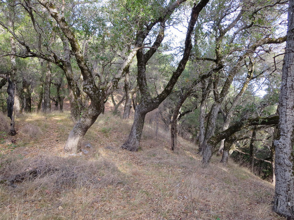
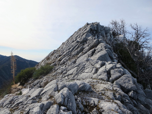
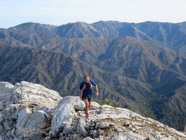
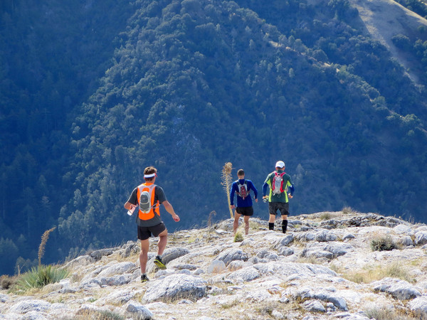
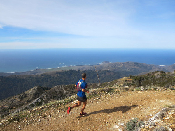
From Bottchers Gap run down the dirt road to the Pico Blanco Scout Camp and then take the Little Sur Trial to a pass between the South Fork Little Sur River and the Little Sur River (this pass is also a low point on Launtz Ridge). From this pass, head cross country WNW through beautiful oak and madrone forest staying on the ridge crest. Eventually the ridge crest opens up into a face with some brush amid white limestone rocks which leads to the north ridge. Once on the north ridge, peer into the chiseled, redwood filled canyon of the Little Sur River. Look ahead to the north ridge route with white limestone cliffs and forested Dani Ridge in the distance . From here, it is easiest to initially stay on the south side of the crest of the north ridge to avoid brushy sections. However, make sure to regain the crest for the second half of the north ridge for some enjoyable scrambling on sticky white limestone. The scrambling is never difficult with little exposure, but the impressive relief on both sides and the outstanding views in all directions make this a highly enjoyable scramble. In fact, it’s so good that you’ll wish it kept going for much longer!


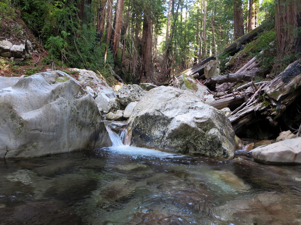
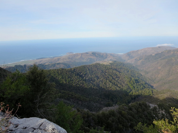
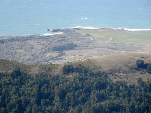
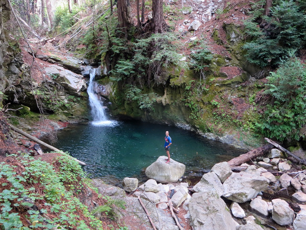
 At the summit, some equipment was recently removed which enhances the view as it is now unobstructed (this equipment, including a weather station, were moved about 400 feet down the mountain at the end of the service road). From the summit enjoy the excellent views of Point Sur, East Molera Ridge and coastal plain, Post Summit, Kandlbinder, Ventana Double Cone and the entire Little Sur River drainage. Perhaps the most impressive view looks northwest down Dani Ridge which separates the deep, redwood-filled canyons of the South Fork Little Sur River and the (main stem) Little Sur River. On the south side of the mountain, the service road comes within a few hundred vertical feet of the Little Sur Trail. A short and easy cross country section connects to the Little Sur Trail which can be taken to lovely Pico Blanco Camp Falls. The falls is set in amid old growth redwoods, a lush carpet of redwood sorrel, five finger ferns and smooth river rocks. The pool beneath the falls has a turquoise color and would make for an excellent swimming destination on a warm summer afternoon. Beyond the falls, take the Little Sur Trail back to the Pico Blanco Scout Camp (with an intermediary climb up to the pass between Little Sur forks) and then ascend the dirt road back to Bottchers Gap. Future aspirations in this region include a grand point-to-point from Bottchers Gap all the way to Pfiefffer Big Sur State Park including Pico Blanco, East Molera Ridge, Post Summit, Cabezo Prieto and Mount Manuel. Strava route here.


Your winter time tours of the coastal Big Sur trails have been awesome viewing. Great photos. -Gus