
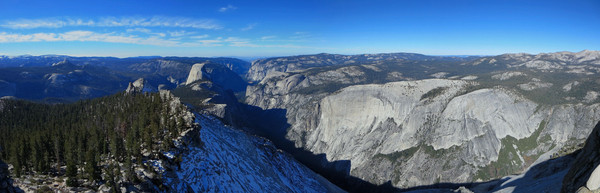
While I know that Yosemite Valley is beautiful any time of the year, I had not experienced the Valley in the fall and I was eager to see some new trails (for me) on the south rim. A Saturday in early November was a great opportunity with the trails on the rim remaining largely snow-free. I designed a 38+ mile tour of the south rim of Yosemite Valley from Clouds Rest to Wawona Tunnel starting with the classic ascent up the Mist Trail from Happy Isles. The aesthetic point-to-point included a number of famous vistas: Clouds Rest, Panorama Point, Panorama Point Overlook, Glacier Point, Sentinel Dome, Taft Point, Dewey Point, Crocker Point, Stanford Point, Inspiration Point and Artist Point. It was amazing to see the changing appearance of Half Dome and El Capitan, the most prominent features in the Valley, as I made my way west along the South Rim. The biggest climb (6,000+ ft) is right at the beginning from the Valley to the summit of Clouds Rest, but the 2,500 ft of climbing from Illilouette Creek to Sentinel Dome is not easy either. All told, there is probably over 12,000 ft of climbing on the route. Beyond Sentinel Dome, the final 12 miles is largely downhill save for some moderate ascent to Dewey Point after crossing Bridalveil Creek. 
 For a high resolution 360 degree annotated panorama from the summit of Clouds Rest, click on the image below or here.
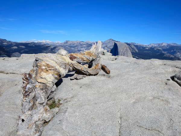
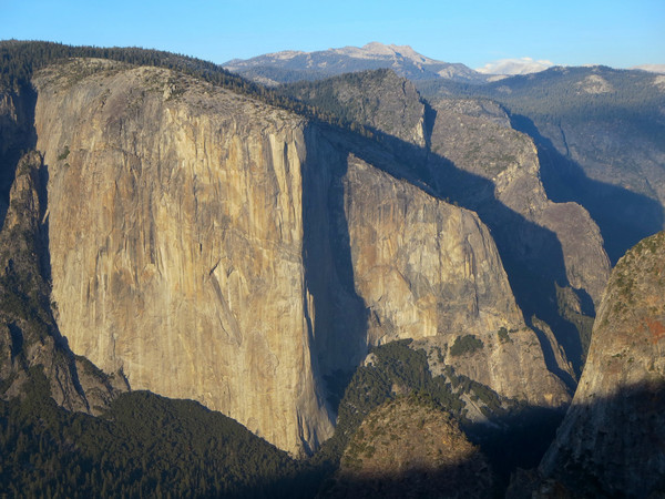
We encountered a surprising amount of snow in the shaded forest between Taft Point and Dewey Point, but overall the trails were in good condition. Panorama Point (not to be confused with Panorama Point Overlook) is a short-off trail hike along a ridgeline with nice 360 degree views. The highest point is at the end of the ridge. Panorama Point Overlook is just off the trail about 700 vertical feet below Panorama Point. A use path leaves the main trail at a switchback above Illilouette canyon, but there is no sign. It looks as if Panorama Point Overlook was once a bona fide vista, but the guardrail has since been removed (or fell off the cliff?) and it’s now one of the hidden gems of the Valley. Being late in the season, it was generally dry and the restroom facilities and water fountain at Glacier Point were closed. This means that if you are going out for a long run you must plan ahead for water locations. In fact, after Illilouette Creek, there is only one suitable water source on the route at Bridalveil Creek. Beyond Sentinel Dome, the focal point of the view is the immense granite wall of El Capitan. Taft Point is a tremendous viewpoint with some nice exposure for photogenic photography. Continuing along the rim, we enjoyed magnificent evening light as we passed Dewey Point, Crocker Point and Stanford Point. It took awhile to find the unobstructed view, but sunset at Inspiration Point was nice and post-sunset glow at Artist Point wrapped up a great day on the Yosemite trails. 


Awesome run and pics – thanks for sharing! I’ve been considering a couple day/night backpacking trip in that area in late December (depending on weather/snow), and just might target Dewey Point for a night due to the views you mention. Night photography would be awesome up there.
Wow, truly amazing pics.
So interesting that you did this trail recently. On Monday I walked only part of it, from Tunnel View to Crocker Point and back. Your annotated panorama will be helpful to me when I try to decipher what’s what on my photos.
Wow. Such amazing shots. Did the 38 miles include the out and back miles from around Liberty Cap to Clouds Rest? Seems like the overall would have been longer. Really great stuff in your blog, impressive accomplishments.