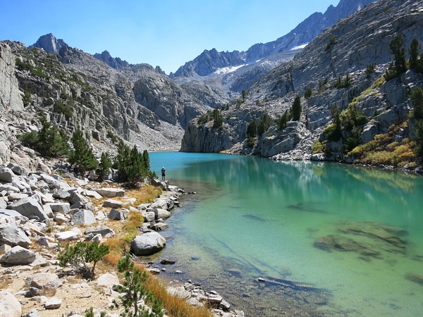
The Northeast Face of Middle Palisade is a classic scramble of a 14er within the rugged Palisades subgroup of peaks. The route takes you past stunning Finger Lake, with its turquoise glacial water and towering granite slabs. The route itself is a long and sustained scramble that technically never reaches above third class. The superb views of the surrounding area make up for the chossy loose scrambling in the lower part of the route. I would actually prefer a more technically difficult scramble that is solid but fortunately the rock improves as one ascends. The climb entails about 7,000 feet of vertical gain and 16 miles roundtrip so it packs a punch. The last time I did this route was six years ago and in the interim I have climbed many more peaks and become well acquainted with much of the High Sierra. In 2009 I could only name a few peaks and was more focused on climbing the well known summits. Now in 2015 I’m more focused on finding the hidden gems in the most remote and wild corners of the range. It was fun to return and see all of the peaks and terrain I have covered over the years and name virtually every summit and major feature visible from Middle Palisade. It was also great to take a more leisurely approach to the climb spending a lot of time at the summit and lovely Finger Lake, one of the most scenic spots in the High Sierra. 

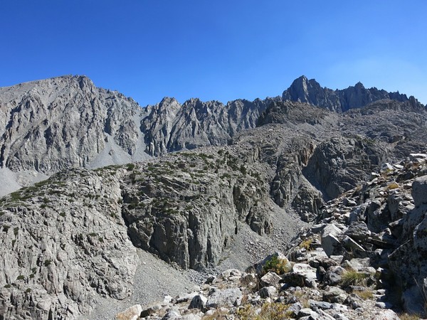
 The South Fork Big Pine Trail travels through a fairly arid environment for a couple miles before reaching the headwall of the South Fork Big Pine Creek. A series of switchbacks commences and when one emerges at the top of the headwall it is a new world of pine trees and spectacular views of the Palisades including Middle Palisade, Norman Clyde Peak, Palisade Crest and Mount Sill. The trail descends slightly and traverses through forest near Willow Lake before commencing a new climb up to Brainerd Lake. From Brainerd Lake the usual route is to take a use path up through a talus field to Finger Lake and then ascend slabs and talus to gain the ridge on the west side of the lake. An alternate route is to traverse the shores of Brainer Lake and ascend the stream toward another small lake as if one were ascending to Southfork Pass. From the small lake ascend friendly slabs to the ridge east of Finger Lake and traverse talus and granite benches to the glacial moraine. Both approach routes meet near the base of the scramble at the talus rib separating the two lobes of the Middle Palisade Glacier.


 The standard route up Middle Palisade begins at the glacier and uses a rock step to gain a chute above. This chute then mergers with a deeper chute that leads to the summit. Glacial recession has caused the access into the “standard” chute to become 4th class or low 5th so the standard route is changing as more climbers opt to take the alternative route which is a reddish white ramp leading to a different chute and does not use the glacier at all. Unfortunately, the reddish white ramp is extremely loose and the lower part of the chute above the reddish white ramp is the fall line (aka bowling alley) for any rock projectiles falling from above. In other words, the alternative chute carries much greater risk of rock fall hazard, particularly in the lower portion. So while the alternative chute has seemingly become the “standard” it is not without its own risks trading more technical scrambling for loose rock hazard. The good news is when the chutes of the standard and alternative routes merge the rock becomes more solid and the scrambling more enjoyable as one makes the final push toward the summit. It would be ideal to do this route solo or in a small group with no additional parties on the route, but lack of people cannot be assumed on such a popular route so it’s better to come prepared with helmets and anticipate some rock fall hazard. It should be noted that any snow on the rocks within the chutes makes the scramble considerably more dicey.

 An example of the loose rock hazard was on my climb I reached for what I thought was a hold but was instead a large rock that was precariously balanced. It didn’t take much more than touching the rock for it to dislodge onto my shin. It was too heavy for me to hold and it proceeded to careen down the chute and over the cliff to its final resting place atop the heap of many other rock projectiles on the glacier. While usual rock fall hazard on this route is golfball to softball size rocks, large rocks can and do fall as manifested by the disturbingly large pile of debris on the glacier at the exit point of the chute. In other words, there is clear evidence of copious rock fall coming down in the chute. Wearing a helmet is absolutely imperative on this route if you care about you head. It should also be noted that releasing loose rocks on a route like this can happen to the best of climbers no matter how careful one may be so the best policy is to come prepared with a helmet and put your head down when rock is called from above or you can hear or see it approaching. On this route it also helps to stay out of the central part of the chute where rock fall is most prevalent and funneled, instead scrambling along the edges of the chute where more solid rock can be found.
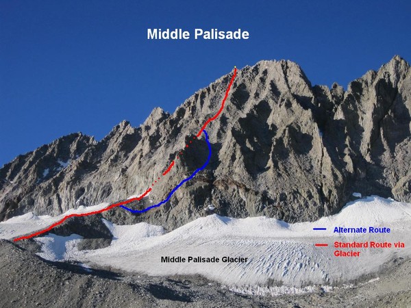


“Now in 2015 I’m more focused on finding the hidden gems in the most remote and wild corners of the range.”
Good! Please continue getting OUT there, so we know what we’re getting into before we ever go.
Thanks!