

Mount Hilgard is a remote peak of the High Sierra in the John Muir Wilderness. It is positioned to the west of Lake Italy on a southerly spur of the Mono Divide. The Mono Divide stretches from north of Recess Peak to Mount Abbot and is one of the more significant east to west oriented divides in the Sierra. Located well west of the Sierra crest, the summit of Mount Hilgard affords a grand view of an impressive spread of lakes and peaks in all directions including the Sierra Crest to the east and the expansive Lake Italy below. The most efficient routes to reach Mount Hilgard involve crossing over the crest from the eastern Sierra via either Little Lakes Valley or Pine Creek. Both routes have their merits and both are incredibly scenic, but the most efficient route (especially as an adventure run) utilizes Italy Pass via Pine Creek which proves to be a straightforward, rewarding approach that is mostly on trail or use trail. Photo album here. Map of route here.


The shortest route to Mount Hilgard starts at Little Lakes Valley and takes the popular trail to Long Lake and then ascends to Treasure Lakes and the “Hourglass Couloir” beneath Mount Dade. A small col at the low point in the crest provides passage into the Lake Italy Basin west of the crest. While short, the route involves quite a bit of steep off-trail travel and will require an ice axe and crampons well into summer to negotiate the Hourglass Couloir. A similar but longer alternative out of the Little Lakes Valley crosses over Cox Col near Bear Creek Spire and will also entail some steep snow and/or ice well into summer. Meanwhile, the route via Pine Creek is mostly on trail for the entire approach to the base of Mount Hilgard utilizing the trail through Granite Park and remnants of old trail over Italy Pass. The only stretches without trail are very easy cross country travel on friendly granite slabs. Moreover, Italy Pass is several hundred feet lower than either of the cols crossing from Little Lakes Valley which means less elevation gain on the return trip. The major drawback to the Pine Creek/Italy Pass approach is the Pine Creek trailhead is 2800 ft lower than the Little Lakes trailhead at Mosquito Flat which means more effort to get into the high country at the onset. Despite the lower start and slightly longer distance, the Pine Creek route is likely still more efficient (especially as a trail/adventure run) and makes up for the lower trailhead and greater distance with ease of travel through gorgeous Granite Park and over Italy Pass. This is the route described next.


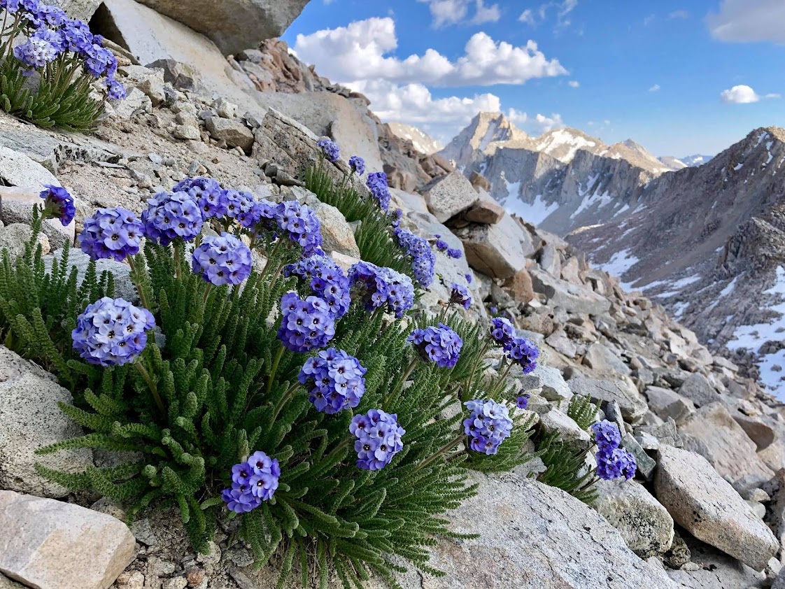
Starting at the Pine Creek trailhead, the trail makes a consistent ascent up the canyon for several miles before flattening out some around Pine Lake and Upper Pine Lake. These lakes are aptly named since they are surrounded by whitebark pines. At the junction near Honeymoon Lake, take the right fork toward spectacular Granite Park. The trail is almost immediately more rugged as the vast majority of visitors bear left to Pine Creek Pass, and makes some steep climbs into the park. Feather Peak, Spire Peak, Bearclaw Spire and other unnamed pinnacles are soon visible and create an amazing backdrop for the many small lakes, tarns and verdant meadows which fill this gorgeous basin. As one ascend through Granite Basin above tree line and into the desolate granite and talus filled terrain, the trail grows more faint to the point that it disappears entirely. A careful eye can follow cairns through the slabs and meadows, but it’s not be worth putting too much effort into it tracking these as the off-trail travel here is straightforward and the destination (Italy Pass) is visible. The paths converge somewhat immediately below Italy Pass, but after the pass it’s largely cross country for another section down the initial slope of granite slabs to meadows.

At meadows northeast of Jumble Lake and southwest of Mount Julius Caesar pick up a usepath again (remnants of the old Italy Pass Trail) which descends to a bench above Jumble Lake. The trail does not descend all the way to Jumble Lake, which is aptly named for the jumble of boulders that surround the lake. Instead the trail traverses above the lake and makes easy work of what would be a tortuous rock hopping extravaganza through an immense field of boulders. Be sure to make note of the trail alignment through this section for the return trip as an off-trail excursion would not be fun. The trail becomes faint on the final descent to Lake Italy, but here the terrain becomes easy once again as the boulders transition back to smooth granite slabs. Once at Lake Italy a usepath becomes more evident once again as it travels through patches of grass alongside the lake. Remanent snow patches last well into summer on this stretch which may be icy in the morning.


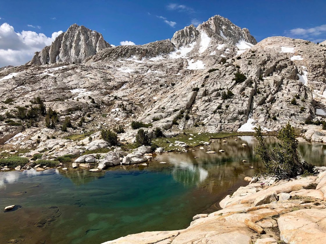
At the outlet of Lake Italy (the Hilgard Branch of Bear Creek) one is finally at the foot of Mount Hilgard. The first part of the climb up to a bench at ~11,600 ft is relatively efficient with slabs and relatively stable rocks. As one ascends into the broad gully on the southeast face, the material becomes progressively more loose and disagreeable as the topography steepens. The climb in this broad gully is likely much better as a snow climb since without snow it’s a slog through steep gravel and embedded loose rocks. Without snow it’s best to bear right and those wishing for more solid scrambling will find it along the southeast ridge. Avoiding the center of the broad gully where the material is most loose is the best policy, except if it’s snow filled in which case be sure to bring appropriate snow gear (axe, crampons) for an enjoyable snow climb.


While the approach through Granite Park and along Jumble Lake and Lake Italy is spectacular, there’s not much positive to say about the climb itself. However, the views from the summit more than compensate for the slog. From Mount Hilgard’s summit perch gaze down onto the entirety of Lake Italy as it resembles a fjord winding among a collection of 13,000+ foot peaks. The terrain up here is desolate but strikingly beautiful with dozens of lakes and peaks visible in all directions. The high peaks from Mount Gabb to Bear Creek Spire are particularly striking, as well as Seven Gables to the south. The good news is that the loose material in the SE face/gully becomes advantageous on the descent, but make sure to look up occasionally and enjoy the striking views of Lake Italy below. With the ascent of Mount Hillgard in the rearview, retrace steps back to Italy Pass and Granite Park. A worthwhile side trip is Mount Julius Caesar which is only 800 vertical feet above Italy Pass. One can take a more direct route to the summit of Julius Caesar from the basin southwest of the peak and then descend directly to Italy Pass on the descent. Mount Julius Caesar has a spectacular view to the triumvirate of peaks that tower above the Royce Lakes – Merriam, Royce and Feather. To the west is the precipitous south face of Bear Creek Spire and distant views of Mount Humphreys are equally impressive.


Outlet of Lake Italy


“Photo album here.” link is 404. Thanks!
Hopefully fixed: https://photos.app.goo.gl/xHEvtkEAjtGTbaDG7