
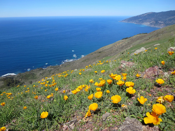
Prewitt Ridge is another striking ridge that I visited over the winter and it was nice to return in the spring as flowers were starting to come out and the grass was turning green. As I mentioned in the prior post, Prewitt Ridge takes the award for the most outstanding views along the Big Sur Coast. The route features an unparalleled vantage of the Cone Peak region to the north and Pacific Valley to the south. The easiest way to reach the ridge is to take the Prewitt Loop Trail for around 1 mile up a series of switchbacks to a junction with the Prewitt Ridge use path. This first mile has great views of the sea stacks at Pacific Valley Bluff and is fairly brush-free. The use path starts by ascending in low coastal chaparral with vistas back to Sand Dollar Beach, Jade Cove and down the southern Big Sur coast. The route emerges from the chaparral onto gorgeous grassy slopes and at a small knoll at around ~1,500 ft Cone Peak reveals itself for the first time. The views continue to improve as the path climbs with another classic vista from a rock outcropping at ~1,800 ft (aka “Prewitt Stonehenge”). At 2,000 ft the route passes by some old sycamores and a spring with a water trough.


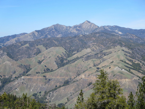
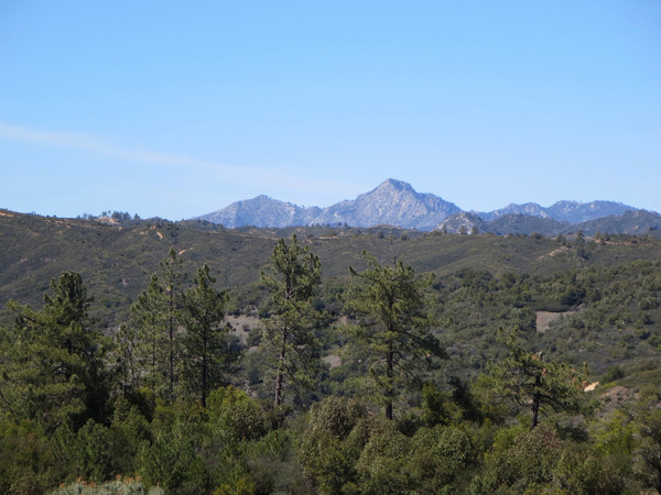
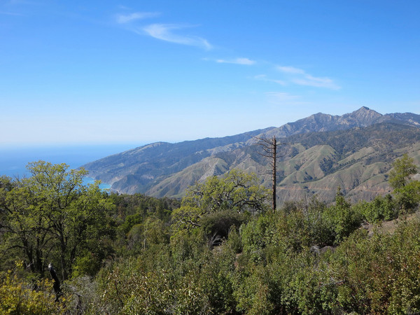
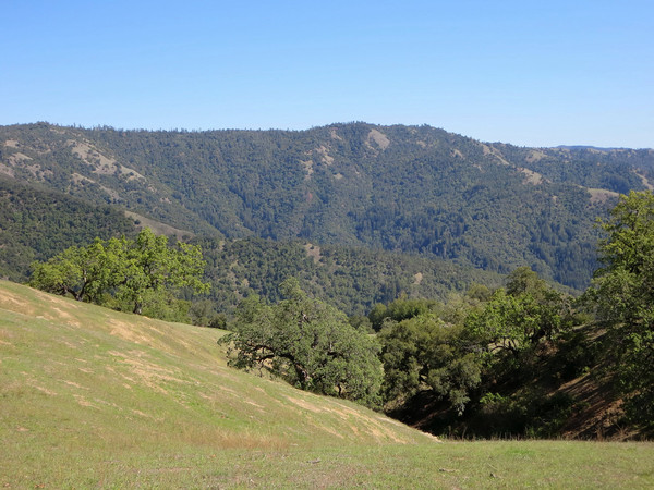
 The next section is the highlight you’re right on top of a grassy ridge with numerous heritage oaks and views in all directions, including deep into the north and south canyons of Prewitt Creek. Cone Peak, the King of the Big Sur coast, rises imperially above the grassy ridges with no ridge more regal than Stone Ridge, which can be viewed from top to bottom in all its glory. After passing through a small forest section, the final portion becomes steeper once again through grassland and patches of pine trees. The route tops out at ~3,100 ft at a magnificent vista point on the South Coast Ridge Road. In all, it’s a little over 4 miles from Pacific Valley to the top at the South Coast Ridge Road vista (8 miles roundtrip). On this day I continued beyond the vista for an out-and-back run along the South Coast Ridge Road. Unlike the Coast Ridge Road to the north, which is well-graded, the South Coast Ridge Road is rolling with a fair amount of cumulative elevation gain. The road generally ascends to a junction with Plaskett Ridge Road and afterwards descends to a broad saddle at the headwaters of Willow Creek. I ran to a point just beyond this broad saddle, which had great views looking into the enormous Willow Creek drainage, but you can continue on for several more miles around the shoulder of Alder Peak and beyond to Lion Peak and Three Peaks. The first part of the road from Prewitt Ridge to Plaskett Ridge Road has many pine trees but the road becomes increasingly devoid of trees and exposed to the sun beyond. There is also no easily accessible water along the road so make sure to carry plenty of water. Upon your return to the trailhead, Sand Dollar Beach and Pacific Valley Bluffs are both nearby; excellent spots to spend an afternoon relaxing after the trip up Prewitt Ridge and beyond. Stay tuned for an additional post in a few weeks with photos of Prewitt Ridge and Boronda Ridge at the height of the lupine bloom, the most prolific display since 1999. GPS route here.


Nice write up I was just surfing a crazy little left wedge off of Prewitt Creek on 8/12 on my way back to Santa Barbara and had no idea what that spot might be called. Nice Pictures. Thanks. I am going to write up my own little thing on this place on my site SurfingRuinedMyLife.net if you want to see this area from a surfer’s point of view.
Interesting to see that valley white oaks (oaks w/bright green leaves , whitish checkered bark are thriving on the coast side of the ocean. They typically hate sea air, and love inland heat. Thanks!