
Back in January I explored the Boronda-De Angulo Loop and thought it would be fitting to return to Boronda Ridge during the short spring period of green. Boronda Ridge rises steeply from the ocean with magnificent vistas of the Pacific Ocean and surrounding terrain. It’s one of the most amazing spots in all of Big Sur. The trail also provides an efficient access point to the central part of the Coast Ridge Road and Marble Peak, with its suburb views of the interior Ventana. 
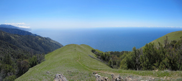
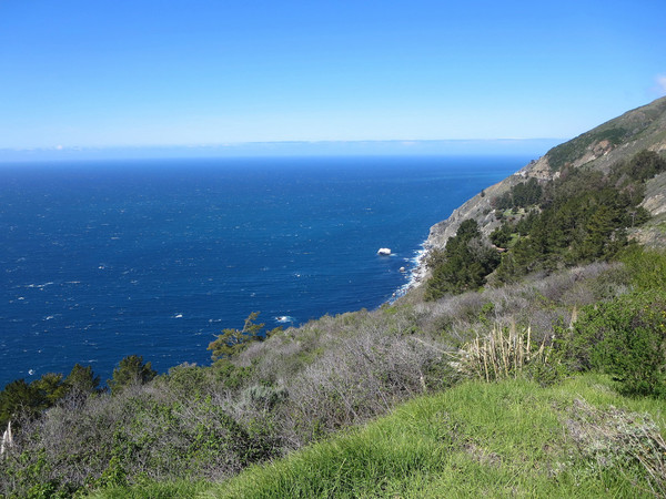
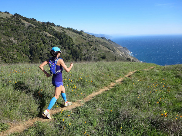
 I view Boronda Ridge as Stone Ridge’s little sister. While Stone Ridge tops out at over 4,800 ft at the summit of Twin Peak, Boronda ridge reaches just over 3,000 feet at the summit of Timber Top. Despite its lower vertical, Boronda Ridge rises more steeply immediately from the ocean with truly impressive relief on the lower part of the ridge. From a vista at 1,500 feet above sea level, the topography is so steep that it’s almost as if you could dive into the ocean! The amazing views on Boronda are virtually non-stop owing to the fact that the ridge crest is almost entirely devoid of vegetation other than grass. The ridge culminates in an elegant arm at the upper part of the ridge. This photogenic rounded arm is separated by deep canyons of oak and redwood with the blue waters of the Pacific Ocean shimmering below. It’s truly a remarkable spot and one of my favorite spots along the Big Sur Coast. The top of Boronda Ridge is a peaklet known as Timber Top, with a camping area (no water) and more phenomenal views.
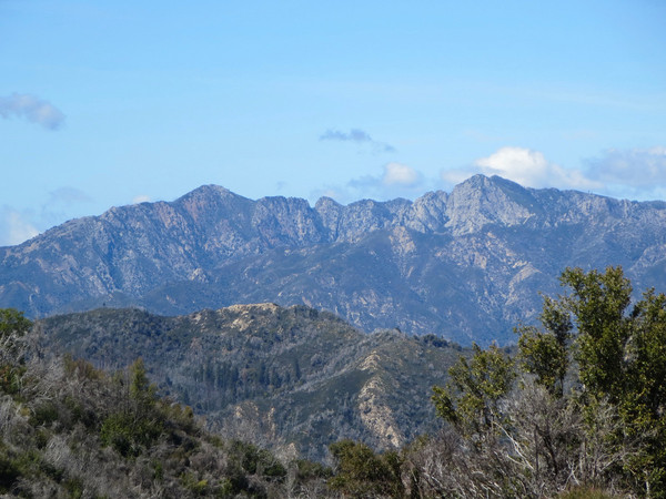
 Boronda Ridge also provides efficient access to the middle section of the Coast Ridge Road (a gravel road closed to public vehicles). Boronda Ridge also provides efficient access to the middle section of the Coast Ridge Road (a gravel road closed to public vehicles). Heading north from Timber Top, the road passes through more grassy meadows as it gradually descends to the Ventana Inn at Big Sur. To the south, the road gradually gains elevation in a predominantly chaparral and pine forest environment with plenty of interior and coastal vistas along the way. The road skirts Michael’s Hill and then has a dip, followed by an ascent and another dip before the final climb to near the broad summit of Anderson Peak. Anderson Peak itself is property of the federal government and contains some buildings, aviation equipment and weather sensors. The summit area is surrounded by fencing and is closed, but fortunately Marble Peak (of nearly the same height) is only a half mile beyond. In fact, Marble Peak arguably has the better 360 degree view because it is more of a pinnacle. Running down the road from Anderson Peak, turn off just past a sign that says “Marble Peak” and briefly take a trail cuts through a brush tunnel. Near the crest of the ridge, leave the trail and take use paths traversing grass on the west side of Marble Peak until you’re almost beneath the summit. From here, a virtually brush free route to the summit presents itself. Marble Peak has excellent views of the interior Ventana Wilderness. Looking north is an excellent view of the rugged ridge from Kandlbinder to La Ventana to Ventana Double Cone. To the south is Cone Peak, Twin Peak, Mining Ridge, and the Lost Valley. To the east is Junipero Serra Peak, Black Cone and the upper drainage of the South Fork Big Sur River. All told, it’s about 7.5 miles each way from the Timber Top to the summit of Marble Peak for a 15 mile roundtrip. Combined with the 6 miles round trip to Timber Top up Boronda Ridge, the route becomes a 21 miles total. The extension to Marble Peak is an excellent way to tack on some miles on relatively fast runnable road, but still enjoy grand views along the way.


Such a joy to find your blog! I lived in pick valley off coast ridge for a few years- ‘micheals hill’ on the topo map. I ran, horse backed and backpacked much of this area- lost valley, Indian valley and pick valley were in my back yard and seeing your pics makes me nostalgic! Thank you !!
Does this trail have good water sources?