
It’s past mid-April, temperatures are warming and wildflowers are blooming higher up the mountains. The snow cone season is coming to an end. Snow events happen occasionally in April, and in fact it snowed an inch or so earlier this week, but the chances for a large snow event are rapidly diminishing. Now is a good time to provide a roundup of the three snow cones that happened this year. I was fortunate enough to attend all three events but there’s a very small chance an event went undetected. In summary, all three snow events were small (2-4 inches), and while there is no historical record of snow on Cone Peak, I can say with fairly high certainty that in terms of overall snow accumulation this was a below average year for snow.

What is a “Snow Cone”?
Cone Peak towers over 5,000 ft above the Pacific, but due to its southern latitude and close proximity to the ocean it’s fairly difficult to get snow on the summit, and even more difficult to get a big snow. A “Snow Cone” is achieved when at least 2 inches of snow falls on the summit. When total snow is less than 2 inches the winter wonderland effect is lacking and snow coverage is insufficient to contrast with the ocean. A small snow cone is anything between 2-4 inches. The majority of snow cones are in the “small” category and all three snow cones this year were small (caveat: the first snow cone may have been a low end medium event on the north ridge). A medium snow cone is anything between 4-8 inches. A large snow cone is anything above 8 inches.

Winter Started in Mid February:
It was a peculiar winter with long stretches where winter was nowhere to be found with a lack of moisture and anomalous warmth. In mid February a sudden stratospheric warming event over the arctic split the polar vortex into two pieces with the more dominant piece moving to western Canada. This triggered fundamental changes in the atmosphere which finally brought some winter to California. At first the change was to a cold and dry pattern but ultimately it transitioned to a cool and wet pattern that delivered the three snow cones in short succession. After some record warmth the last week of March cooler air and moisture returned in early April but it appears the shortened winter season is relenting to a typical spring pattern. At least the few weeks of winter this season was better than no winter at all which was experienced during a couple of the drought years.
Snow Cone #1:
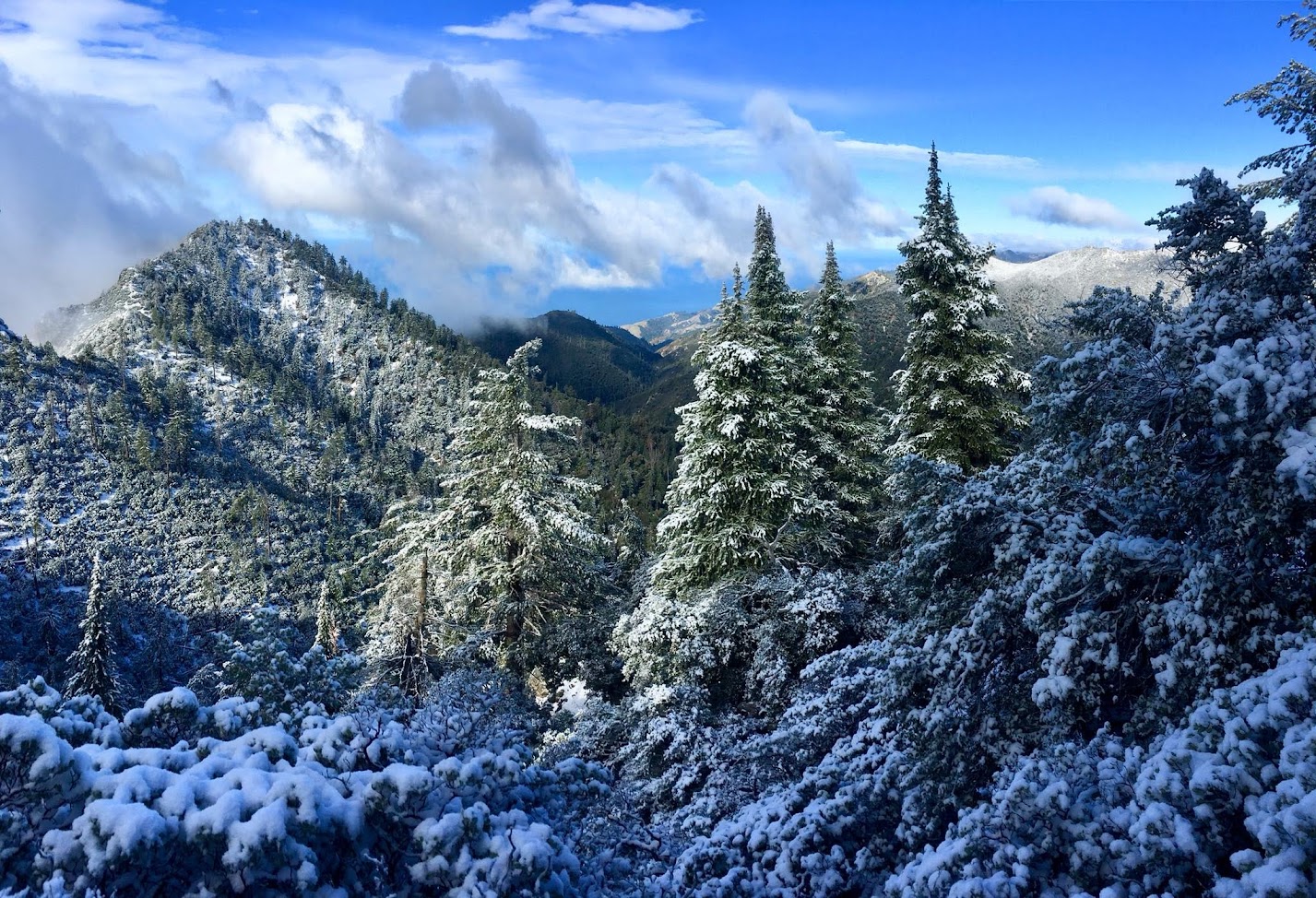
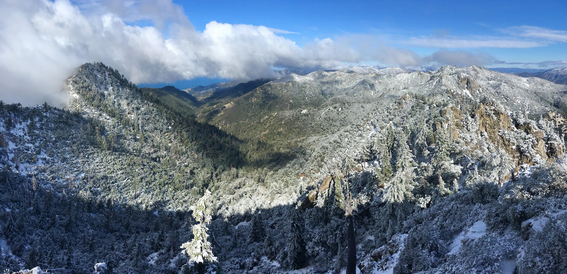
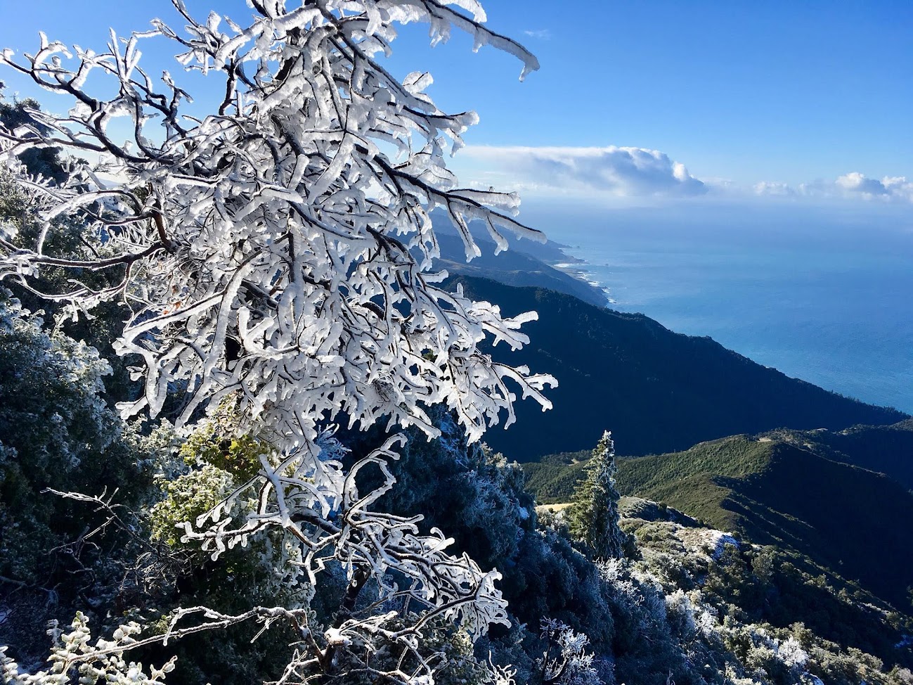
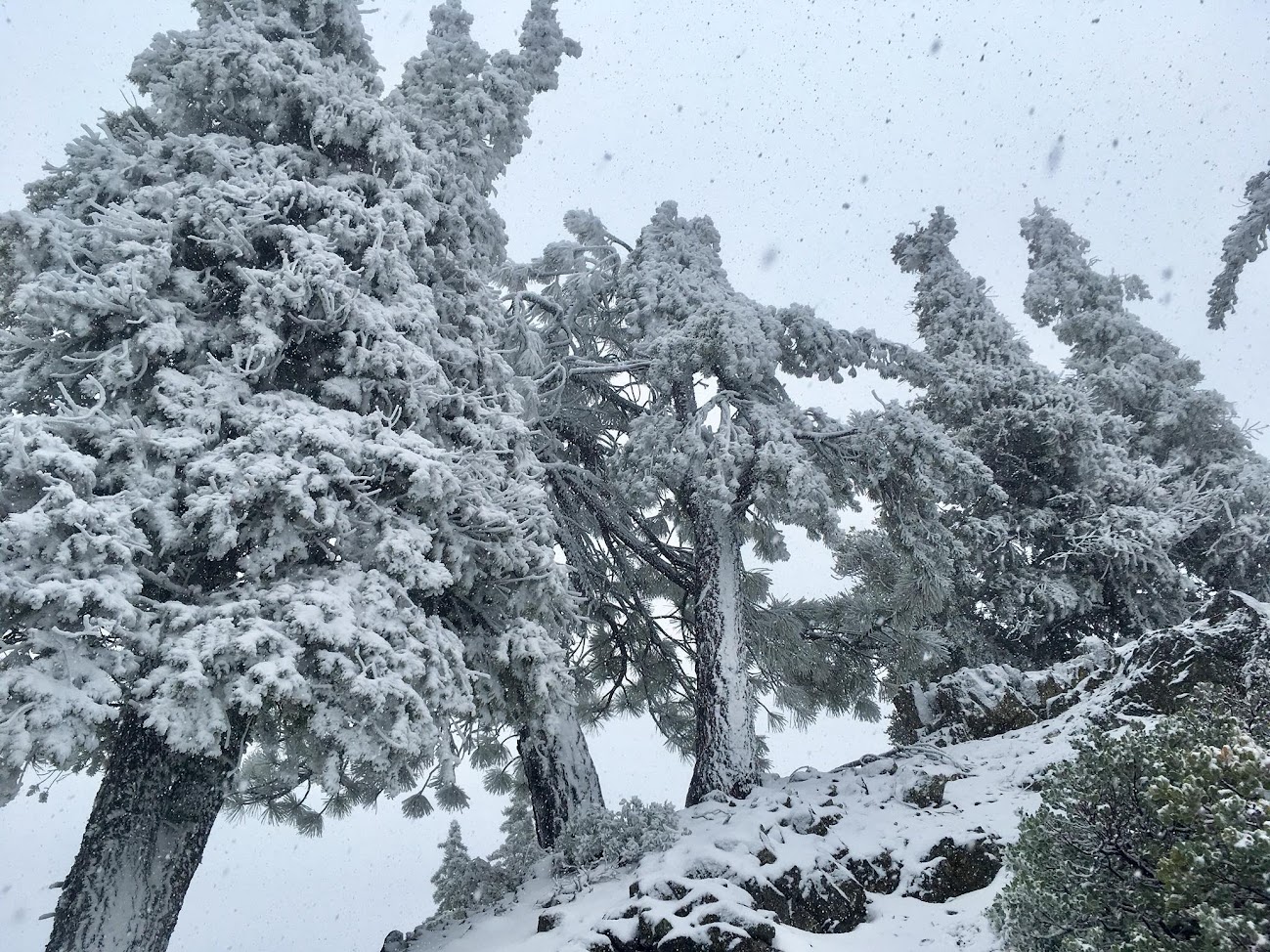
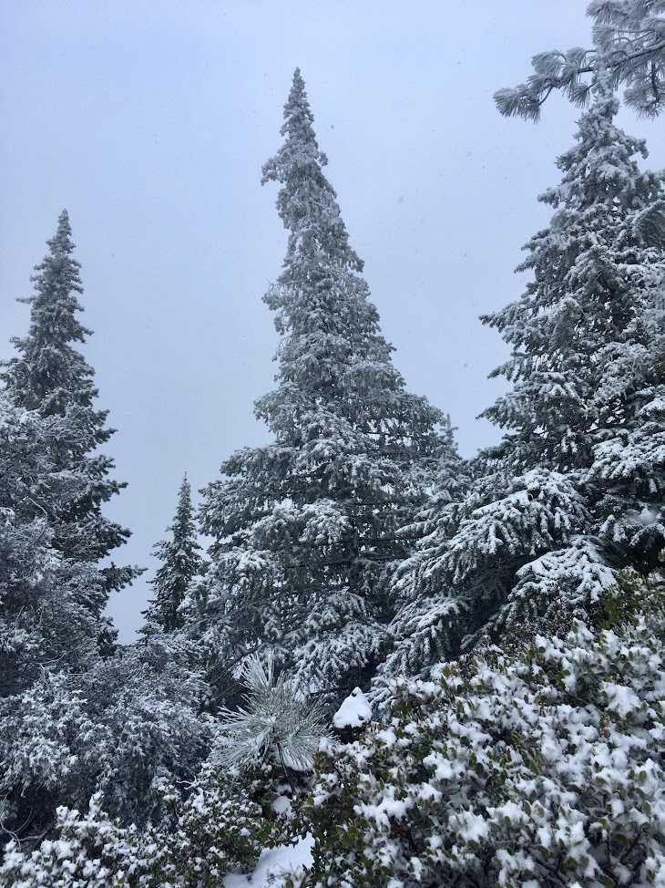
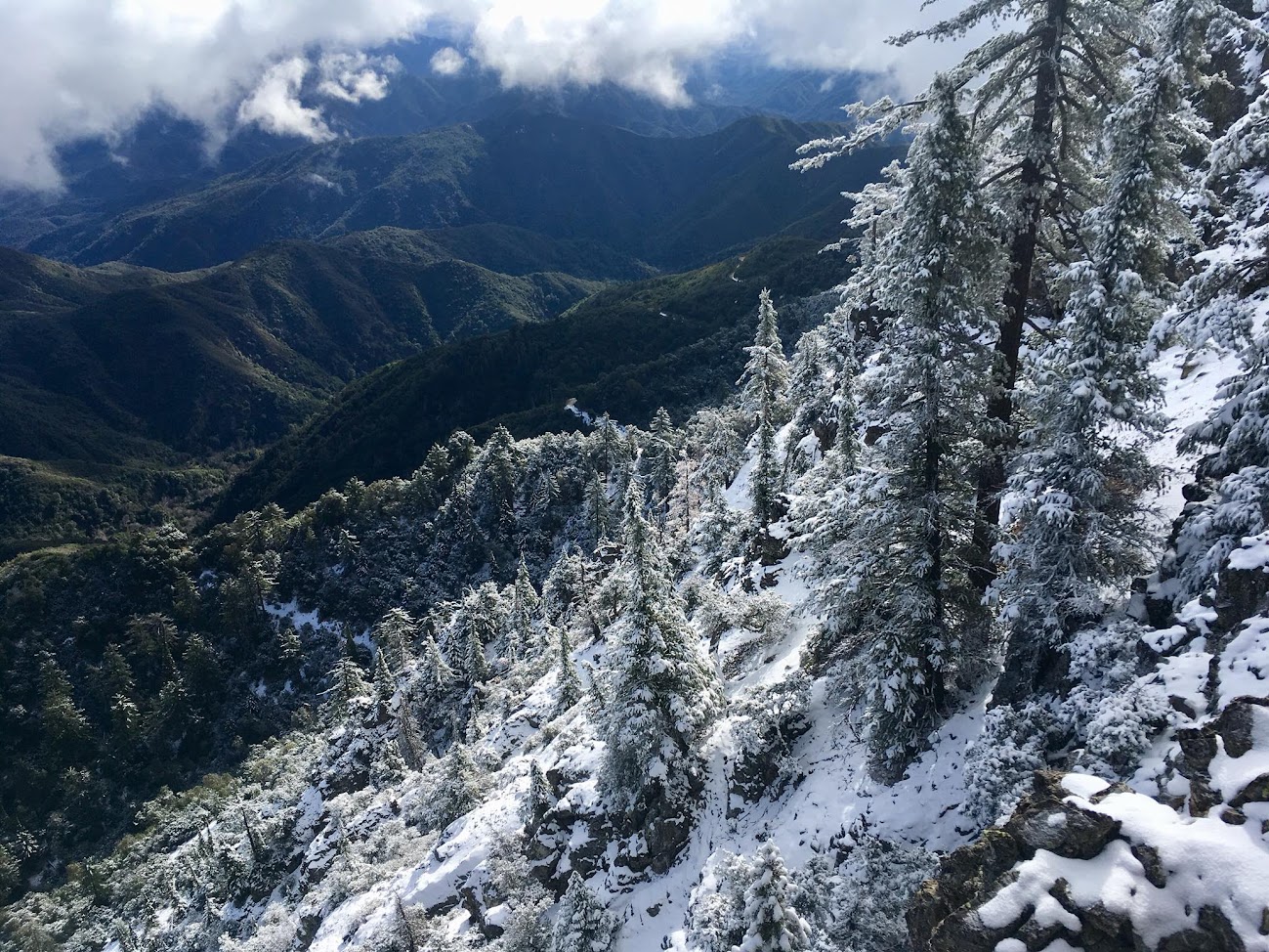
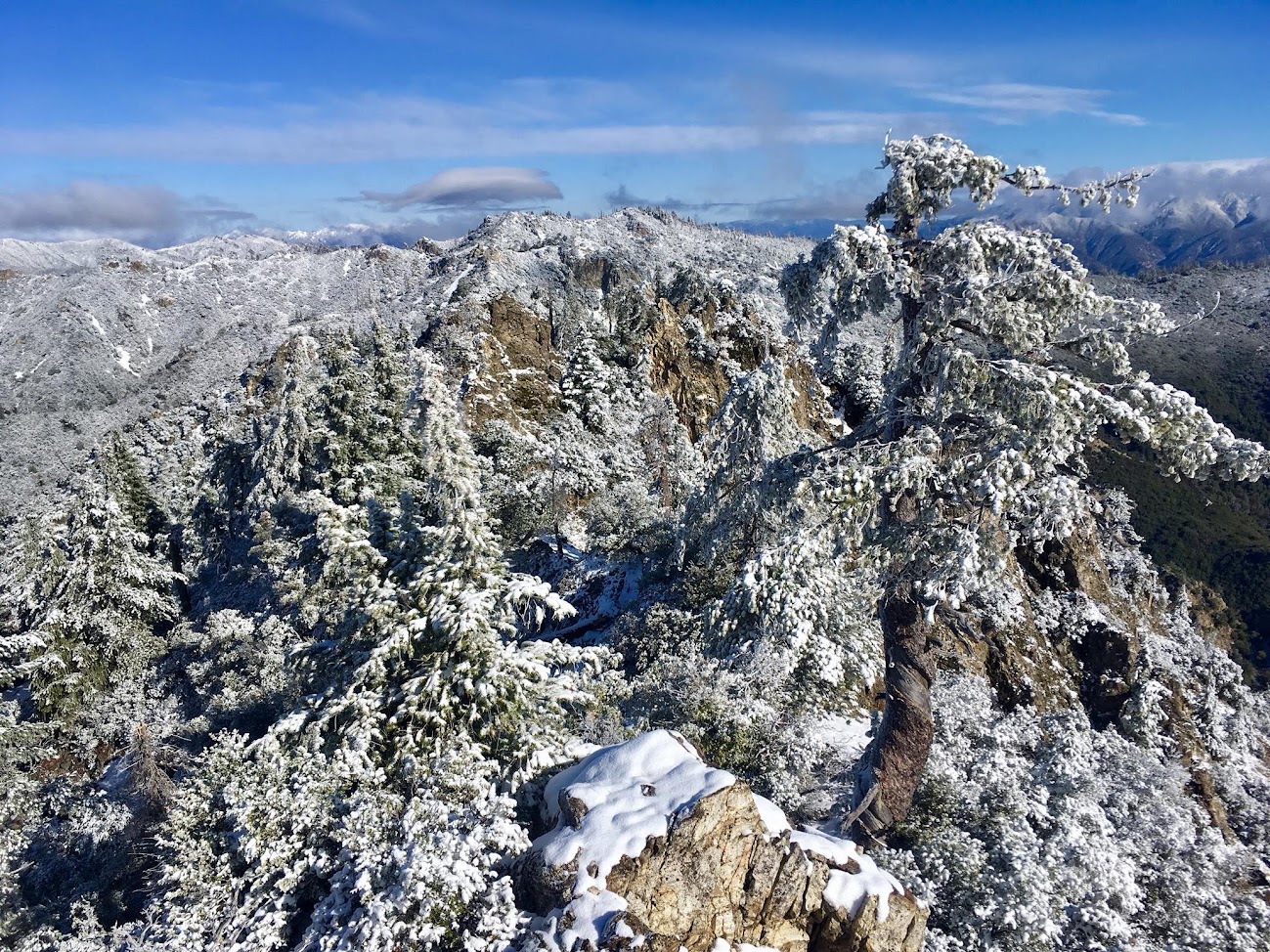
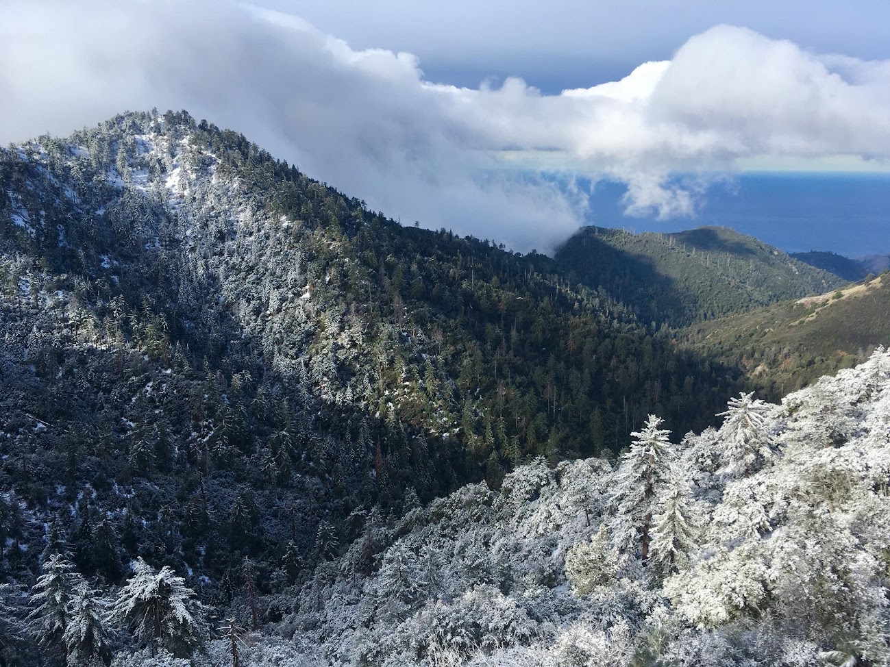
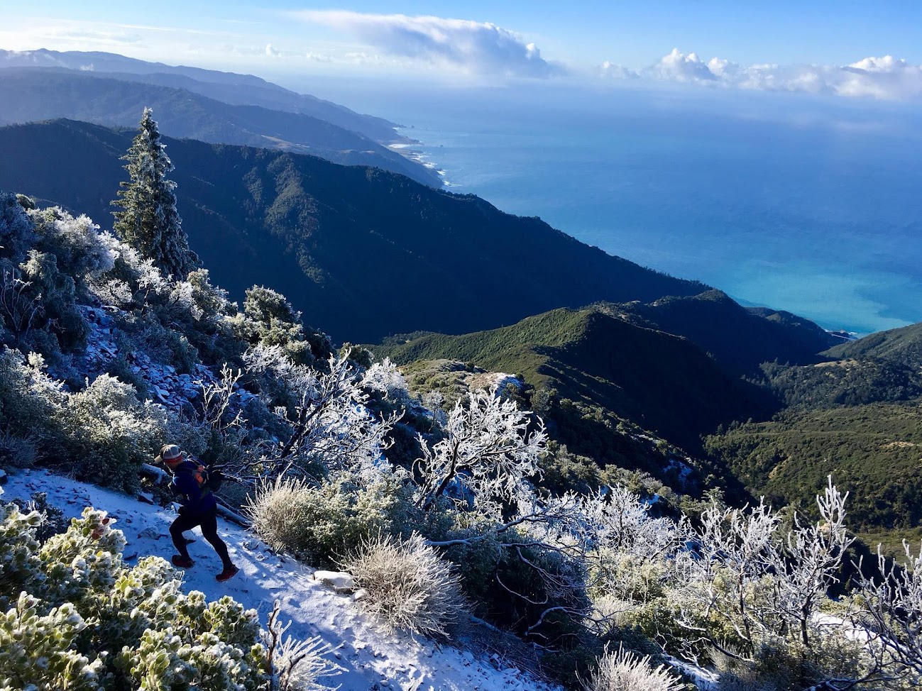
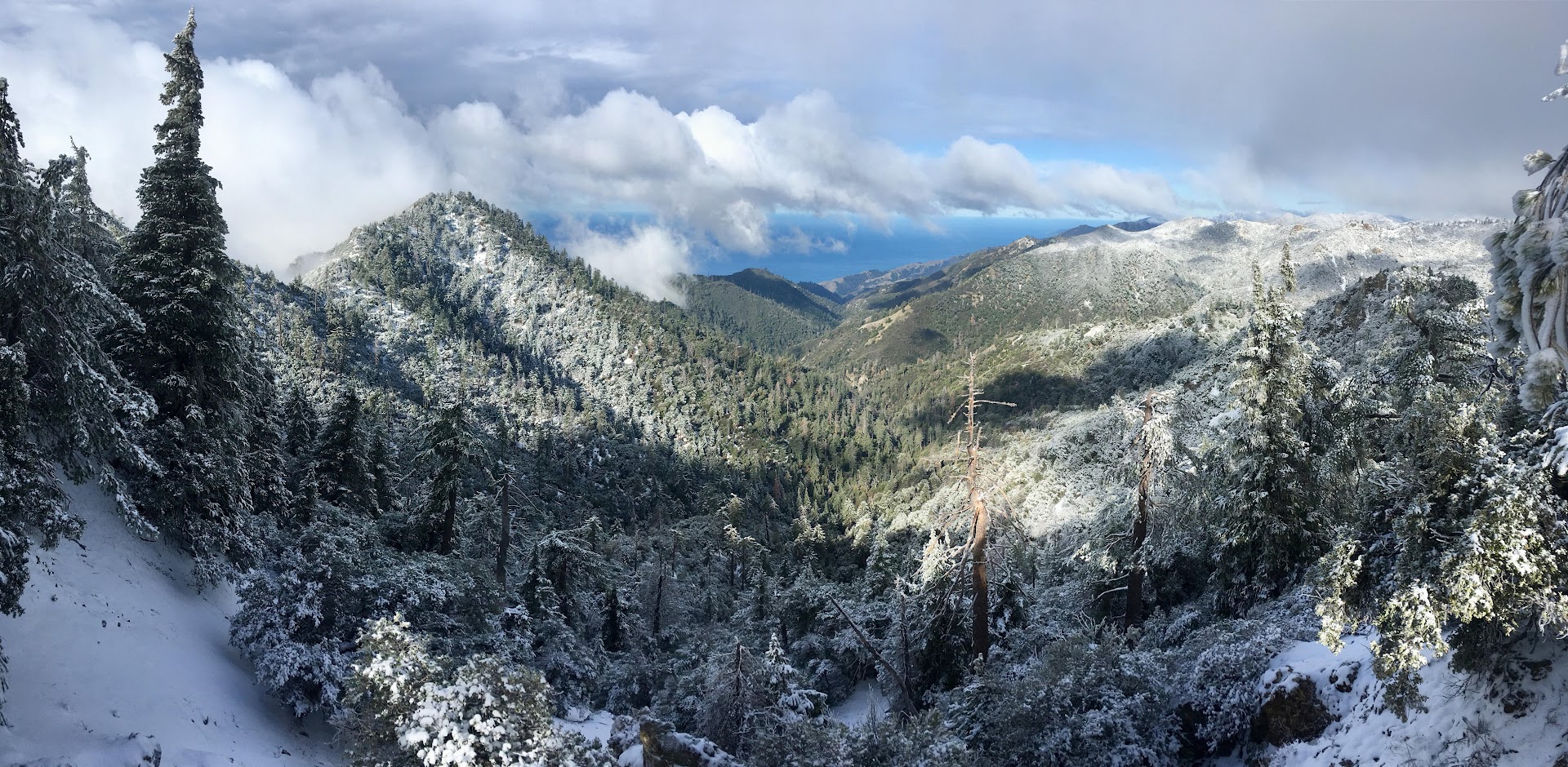
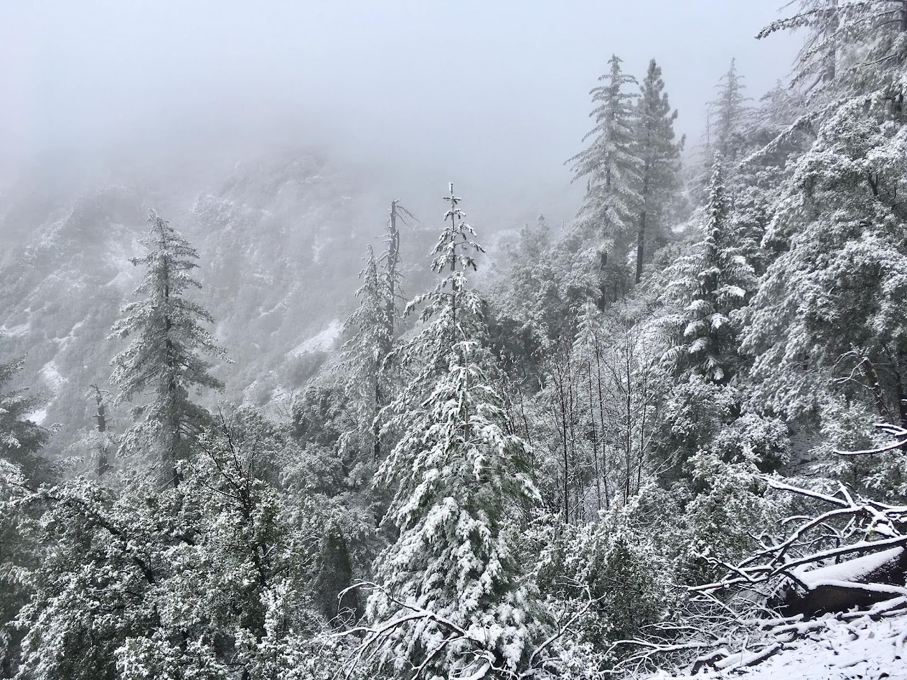
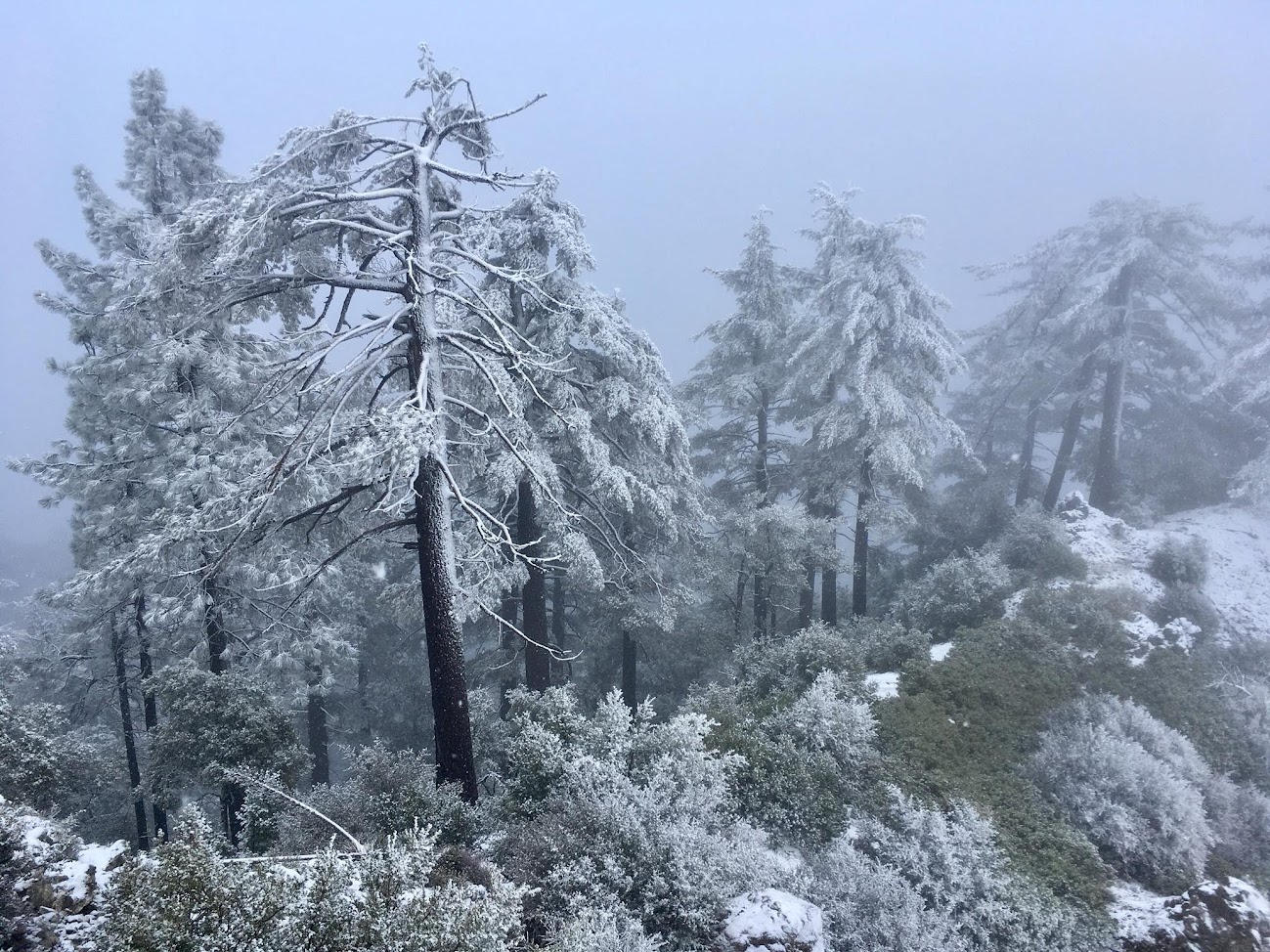
The first snow cone resulted from a cold front moving down from the north on February 26th. While moisture starved, the front had just enough for around 0.4 inches of liquid precipitation. Temperatures were already cold enough for snow at the onset of precipitation despite the fact that virtually all of the precip occurred during daylight. After the front passed, modified arctic air moved in holding all the snow in place overnight and into the next morning. Snow levels were down to 3500 ft. There was 3-4 inches on the summit and up to 6 inches in wind sheltered spots on the north ridge. These spots on the north ridge might qualify as a low-end medium snow cone, but overall the event was still small. While not deep the cold temperatures kept all the vegetation covered in snow so the winter wonderland was in full force. The frosting on the trees and the views down Devils Canyon contrasting with the green below and the blue ocean were fantastic. Snow Cone #1 full album here.
Snow Cone #2:
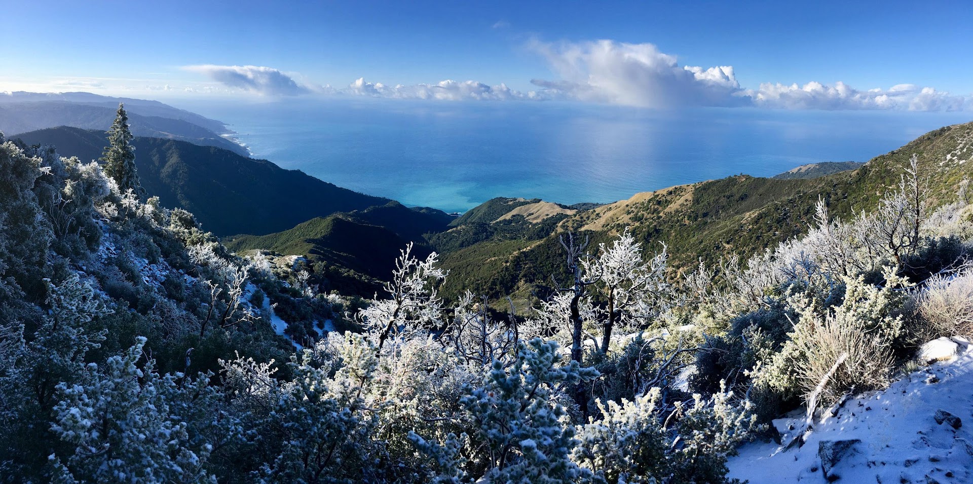
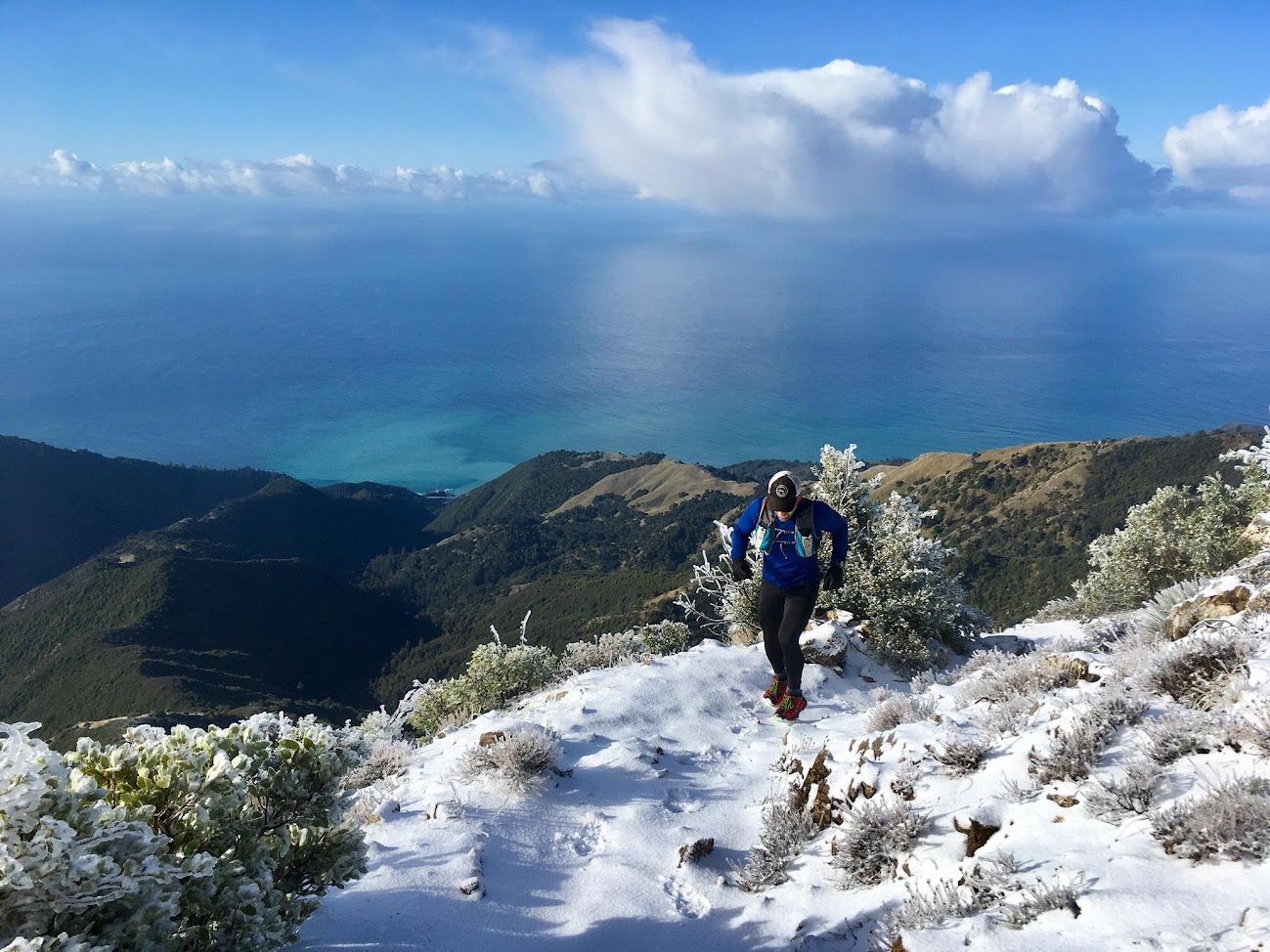
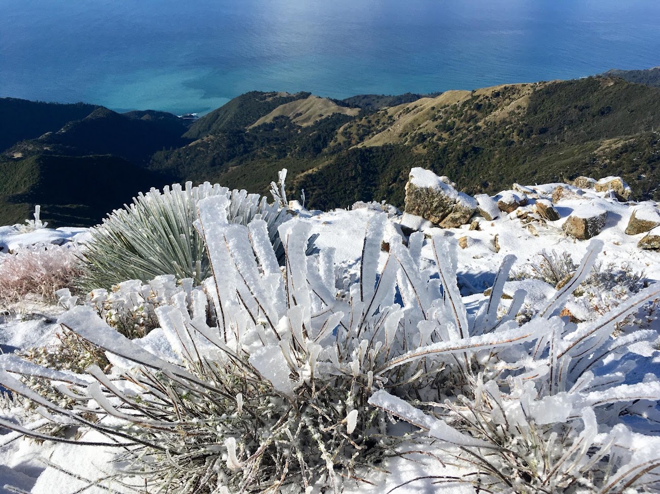
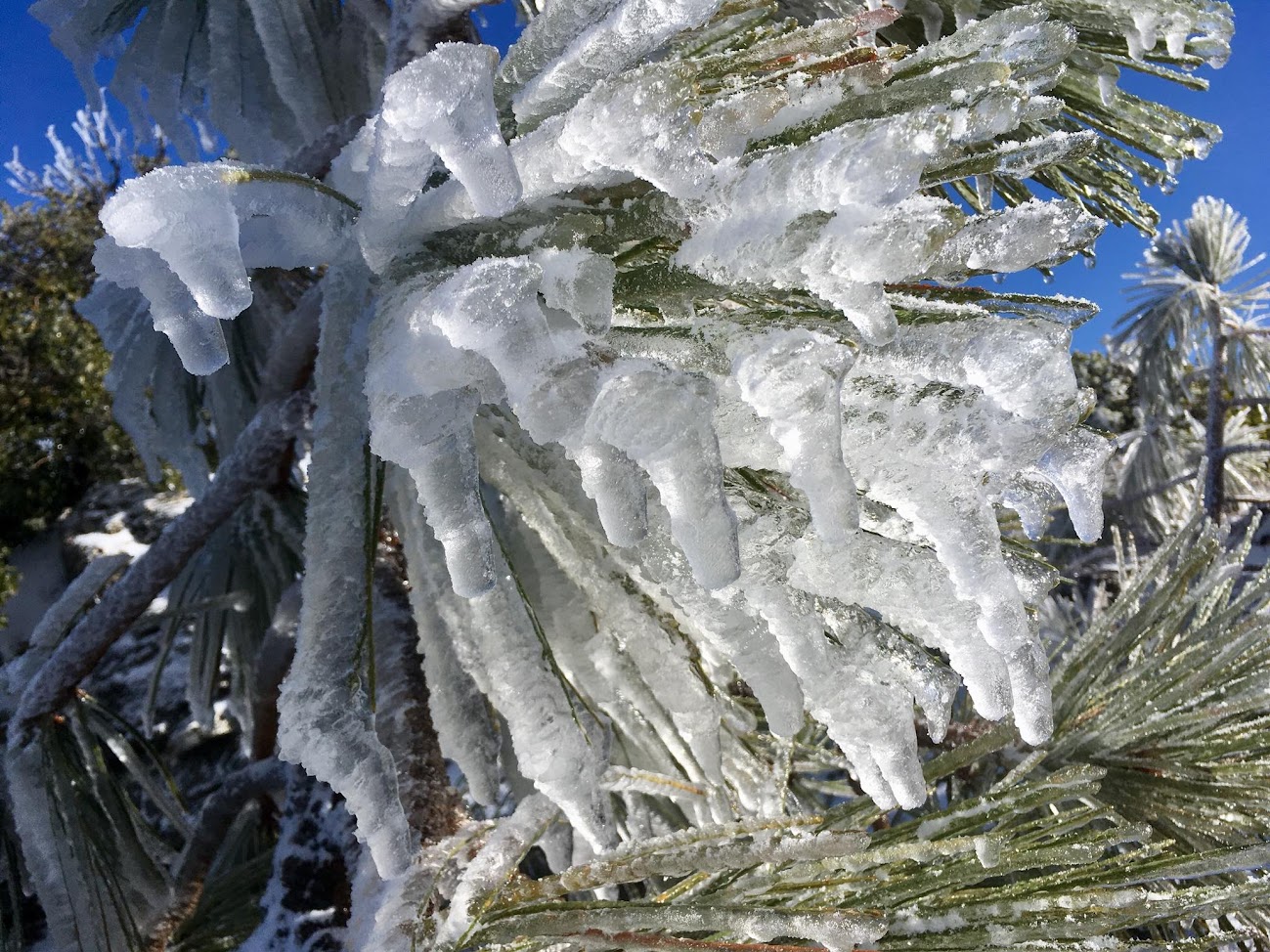
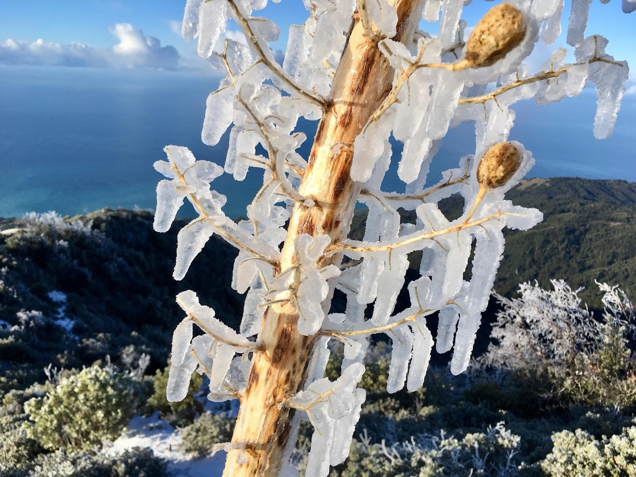
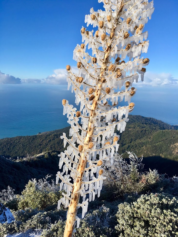
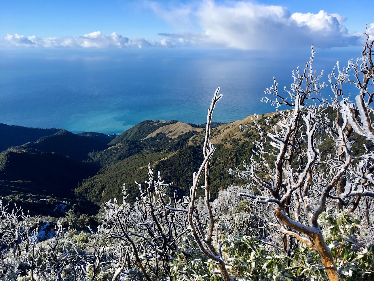
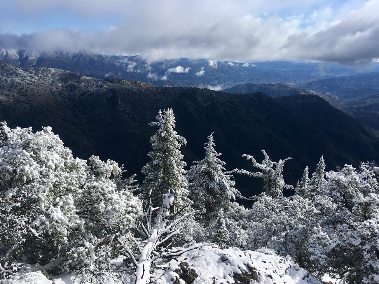
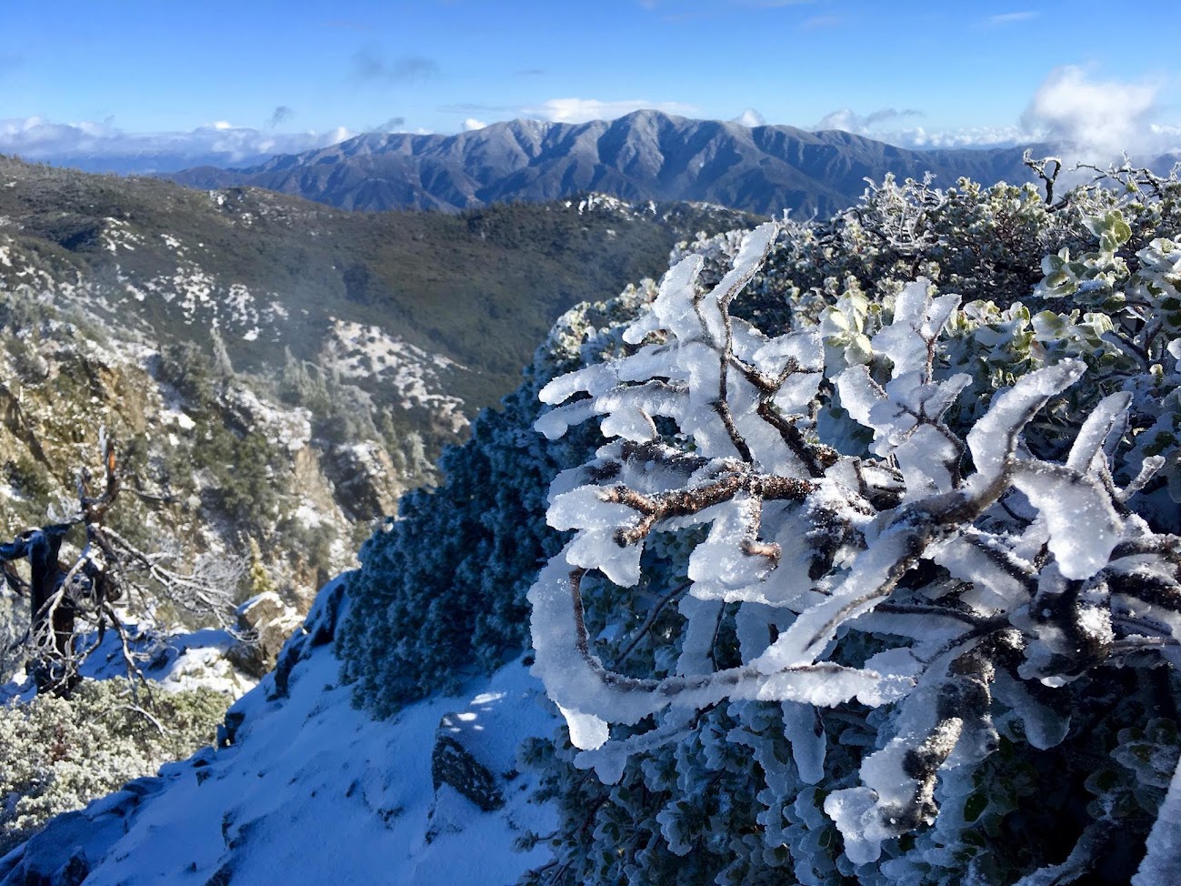
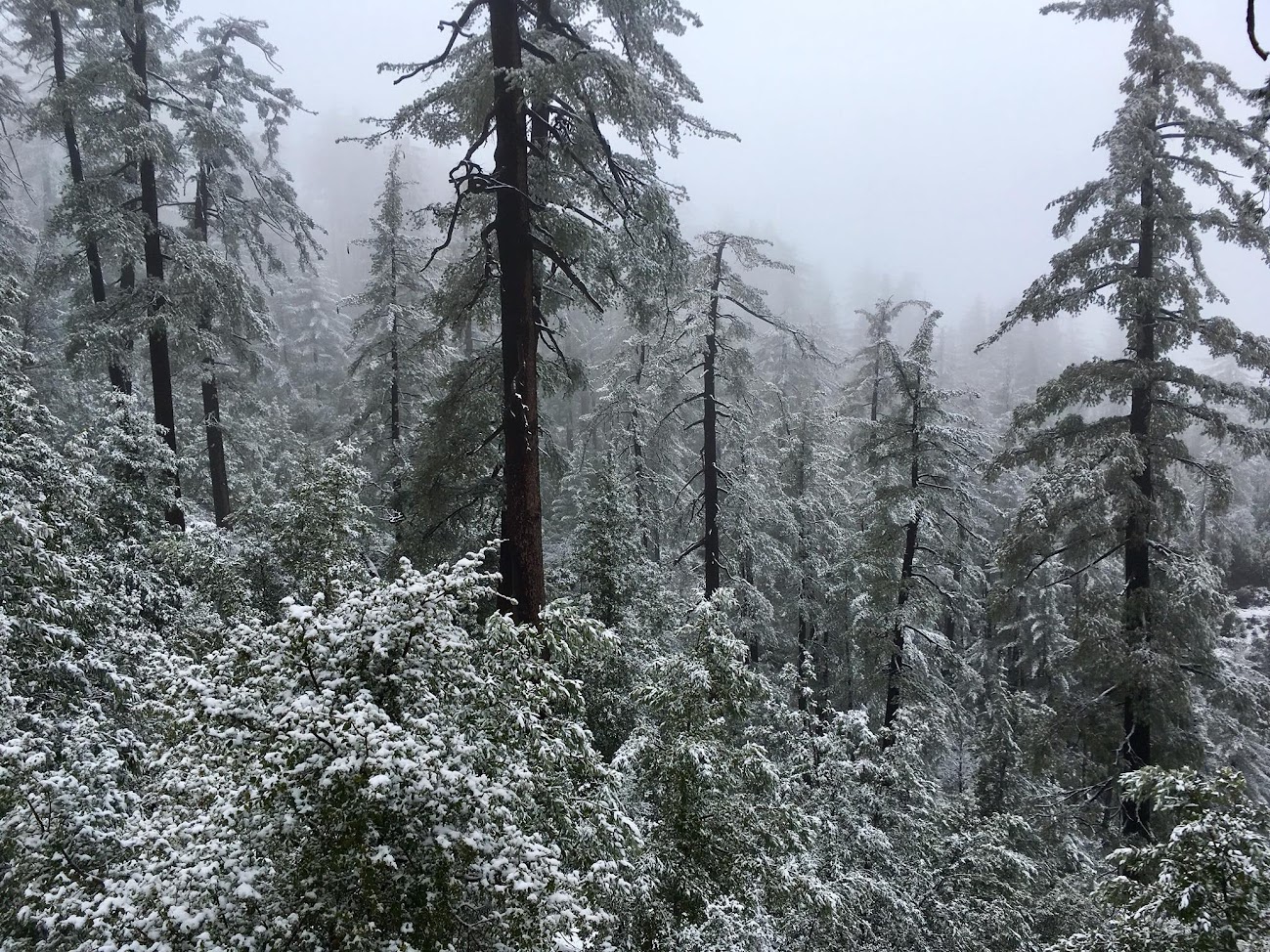
A few days later a stronger system arrived but there was a nose of warm air during the heaviest precip which resulted in rain. As the front passed temperatures cooled below freezing once more but most precipitation was mostly over. However, fog and low clouds persisted on the upper mountain and the water vapor droplets in the clouds freezed upon contact with the vegetation resulting in rime ice. Over the span of many hours, the rime accumulated to 2+ inches! Early in the morning on March 3rd some showers passed resulting in a small snow accumulation of around 2 inches on the summit. Toward Tin Can Camp and Cook Spring the snow accumulation was more like 3-4 inches. The icing was spectacular with crisp and clear views to the ocean. This event was light on snow but heavy on ice. Originally the hope was that the entire event would be snow, but the track of the parent low pressure was simply too far north which allowed warm air to precede the front. This is an excellent example of how critical the track of the low pressure is to snow prospects. Had the low tracked down the central coast (as opposed to far Norcal) this would have been a large snow event (foot+). Snow Cone #2 full album here.
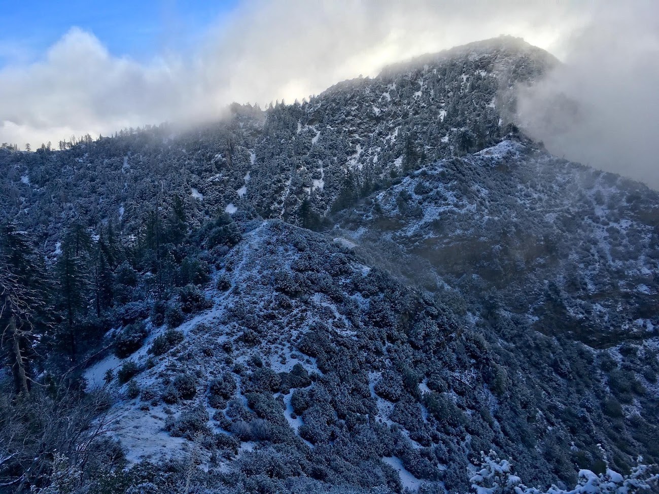
Snow Cone #3:
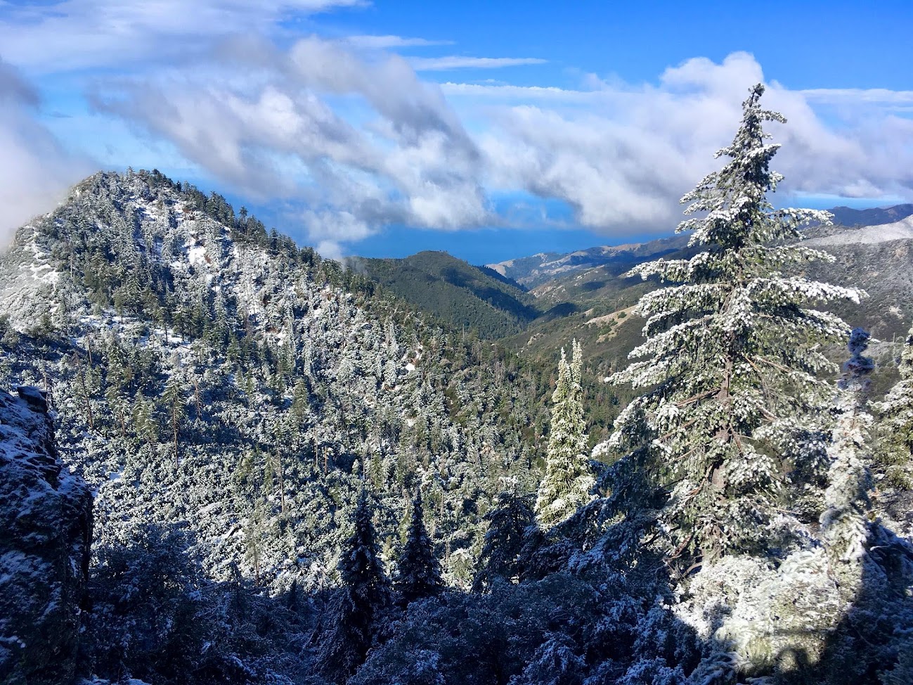
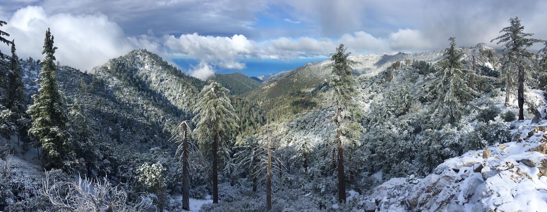
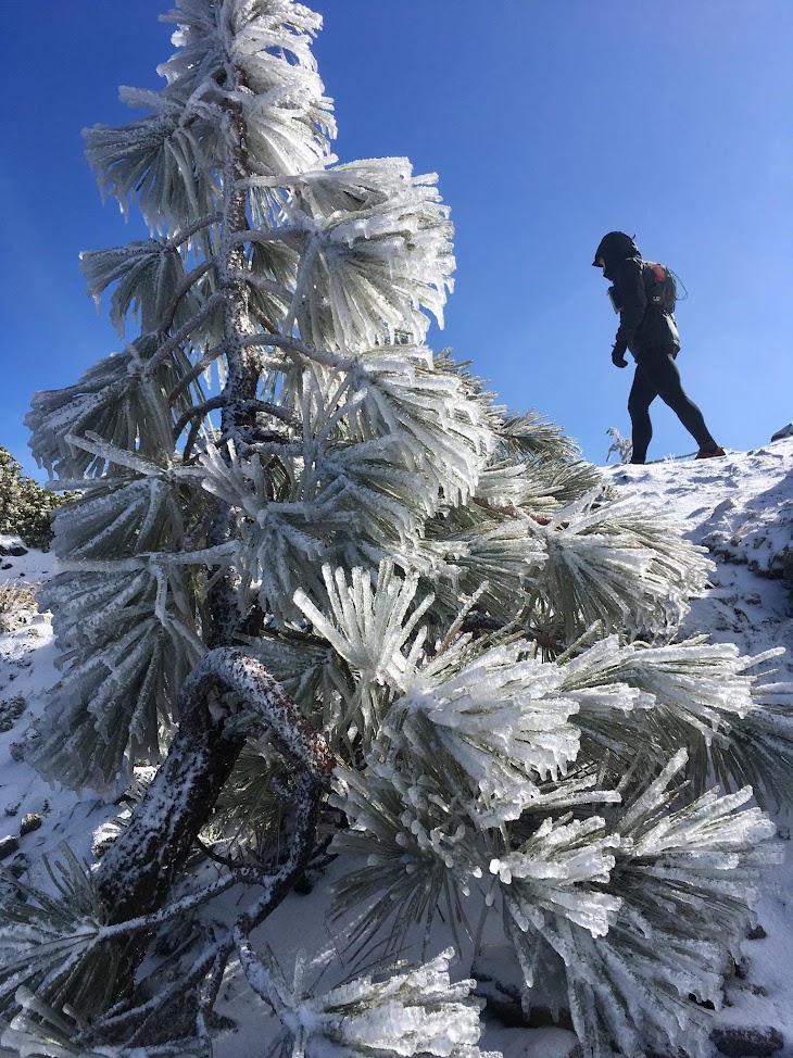
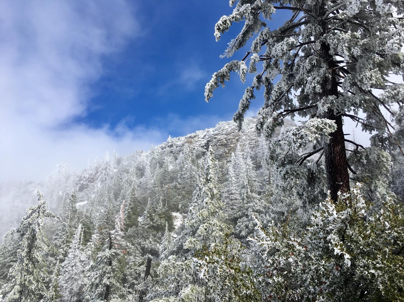
A couple weeks later there was much anticipation for a bigger snow event with the hope that the parent low would track south along the coast and into Central California where the coldest air and moisture would combine for a big snow event. This type of track is the “sweet spot” and could result in feet of snow. However, the hopes were dashed when once again the track shifted more to the north into far NorCal. This eliminated the chances for a big snow cone but the air was still sufficiently cold for snow showers on March 17th. In addition, there was some daytime snow showers up high providing my first opportunity to experience the snow falling while on the summit. Around 3 inches accumulated on top while 4-5 inches fell around Cook Spring. Unlike the two prior snow events the clouds were persistent and aside from a few peaks of sunshine it remained socked in all day. A favorable track of the low never materialized this season, thus the small nature of the events. Snow Cone #3 full album here.

Snowfall Historical Record:
There is no historical record of snow on Cone Peak, but a somewhat useful shorthand is the snowfall record on Mount Hamilton in the Diablo Range. At 4,360 ft, Mount Hamilton is 800 feet lower than Cone so it will generally not receive as much snow in events where the snow line is 4,000 ft and higher. In addition, Cone can receive more precipitation than Hamilton due to its close proximity to the coast. On the other hand, Mount Hamilton’s inland location can allow it to overcome the modifying effects of the ocean more efficiently resulting in colder temperatures and snow where it’s otherwise rain closer to the ocean. Overall, I suspect it snows more on Cone Peak than Mount Hamilton. Looking at the historical record on Mount Hamilton there are boom and bust years. Some storm cycles delivered feet of snow while other years went completely free of snow. The “average” is skewed by the big snow years and comes out at 17.7 inches. Starting with the 2012-2013 winter Mount Hamilton hasn’t even come close to the historical average. That’s five years in a row of either no snow or much below average. 3.5 inches of snow was recorded on Hamilton this year which is much below the average. Cone Peak had a localized big snow event last winter that did not effect Mount Hamilton so last year was around what I assume is average for Cone (but was well below average on Mount Hamilton). Most of this snow drought is a result of the multi-year precipitation drought and the warmer nature of storms with a subtropical tap that elevates snow levels above the Santa Lucias. After a long hiatus the Gulf of Alaska finally woke up in late February and March of this year so hopefully that portends some bigger snow years in the future, but at the same time I’m worried that climate change is reducing the opportunities for snow on the local peaks. Most snow events have always been marginal in these mountains, and if temps rise even a degree or two, it makes it all the more tougher to get snow. This makes it extra important to enjoy each snow event.

Chews Ridge:
While Cone Peak is a magical spot for snow, it is not the snowiest spot in the Santa Lucia Mountains. The candidates for that award are Chews Ridge and Santa Lucia Peak (aka Junipero Serra Peak). Chews Ridge is slightly shorter than Cone, but its farther inland position at the north end of the Santa Lucias allows it to accumulate substantially more snow than Cone, particularly in NW flow events. Santa Lucia Peak is substantially higher by around 700 feet so it’s conceivable the summit of Santa Lucia Peak receives snow in several events that are marginal on Cone Peak or Chews Ridge. On balance, however, I believe Chews Ridge is the snowier spot as it’s perfectly situated to squeeze out moisture in NW flow regimes which is the most frequent pattern that produces snow in the Santa Lucias. In addition, Chews Ridge is consistently colder than Cone Peak despite being of similar height due to it’s inland position where the moderating effects of the Pacific Ocean are reduced. For example, during the second Snow Cone event this season, the Chews Ridge area was able to accumulate 6-8 inches of snow – at least twice as much as Cone. There have been several events with convective showers in NW flow where Chews Ridge can receive several inches of snow while Cone Peak is completely “snow shadowed” with no snow. In order for Cone to partake in these post-frontal shower events, the flow has to be more out of the west, otherwise the snow shadow effect of the mountains to the north will reduce or completely eliminate snow on Cone Peak. While there is a facility on top of Chews Ridge with a weather station, there is no historical record of snowfall available. Chews Ridge certainly receives more snow than Mount Hamilton and its closer proximity to Cone Peak would be a better comparison, but alas no such record exists. If you’re looking for the most snow, however, chances are it’s in the Chews Ridge area.


I ended up going up to Twin on 3/4/18. Was at the summit at 9:04am and quite a surreal experience seeing the snow on Cone contrasting Hare Canyon and the beautiful Pacific ocean.
Beautiful views and incredible photos! The ice on all the plants looks really, really neat!
I am on cone peak at this very moment. It is 11:25pm on Feb. 6th 2019. There is approximatlety 6 inches-8 inches of snow with over a foot piled in steep spots along the trail. What a beautiful mountain!
Hope you enjoyed my tracks!