
I joined Gary for a fantastic 13 mile trail run through the Mount Tamalpais Watershed (see Gary’s GPS track), which is located on the north side of Mount Tamalpais and is managed by the Marin Water District. These trails are much less visited than the popular trails of Muir Woods National Monument and Mount Tamalpais State Park. In fact, there are no organized trail races permitted on these trails. Cataract Falls and Bon Tempe see the most traffic, but there are myriad of delightful single tracks further back where you can find solitude on even the busiest weekends. Running these trails has been high on my list for a long time, but it took me until now to finally get in a comprehensive run here.

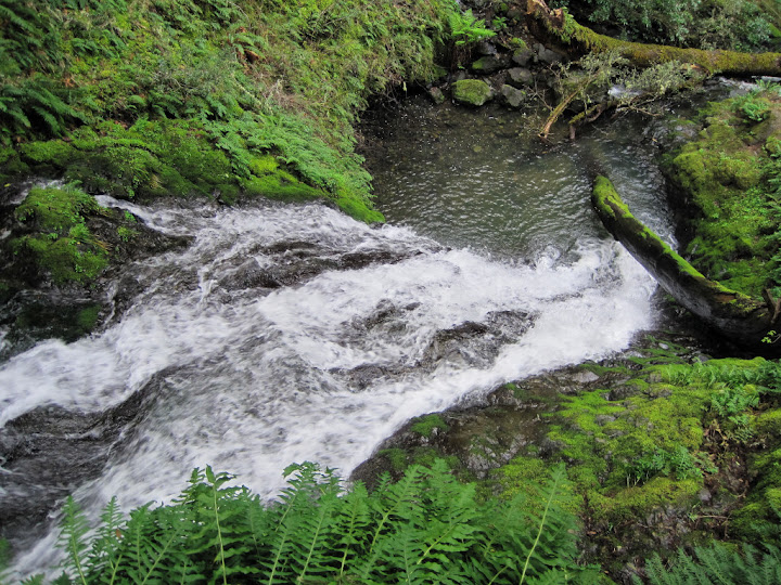
I was most excited to see the complete Cataract Falls from top to bottom (about 1.5 miles) and I found that some of the best waterfalls in the string of cascades is near the bottom by the outlet of Cataract Creek into Alpine Lake. I can now say that Cataract Falls is one of the best waterfalls in the Bay Area, especially because of its gorgeous setting amidst lush ferns and moss and numerous waterfall segments keeping it interesting the entire way. The rest of the watershed provides great variety, including lush redwood canyons, more spectacular waterfalls, meadows, panoramic vistas, and lakes. The trail running can be challenging with steeply graded climbs and technical trails, but the rewards more than compensate. I had a great time on these trails and I look forward to returning to the Mount Tamalpais Watershed to check out the many other trails I have yet to run! Check out this short video I made of Cataract Falls and the Mt. Tamalpais watershed.
Photos of the trail running splendor!


Our route and more photos after the jump!

Our route starting from Rock Springs Trailhead (see Gary’s GPS Track) – Mt. Tam Watershed Map:
- Cataract Trail all the way down to Alpine Lake
- Back up to Helen Markt Trail
- Kent Trail along Alpine Lake
- Bon Tempe Shadyside Trail
- Berry Trail
- Lagunitas – Rock Spring Road
- Down Rocky Ridge Road
- Stocking Trail
- Azalea Trail to Rifle Camp Picnic Area
- Portrero Meadow Trail
- Benstein Trail


I hiked a similar loop a few weeks ago. You’re right – there are some excellent, uncrowded trails on Mount Tamalpais’s north side. Away from Cataract Falls, I didn’t see anyone for hours.
SO beautiful! I’ve put this on my list of trails to run on vacations. This is amazing and has me wanting to hit the trails right now.
wow,so beautiful places,exciting
Thanks for the inspiration! I did a very similar loop today, inspired by your post.
I think I found a nicer return that I wanted to tell you about: Instead of turning south up Lower Berry Trail by Bon Tempe lake, I continued east to lake Lagunitas and climbed (steep!) Colier Spring Trail to Northside trail to Rifle Camp.
It is the same distance as your path I think it has less fire-road running.
Again, thanks for the tip – I really enjoyed myself today!
Thanks Bjorn. There are a myriad of fantastic options around Mount Tamalpais, it’s tough to go wrong with any of them!