
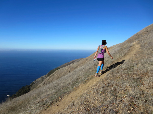
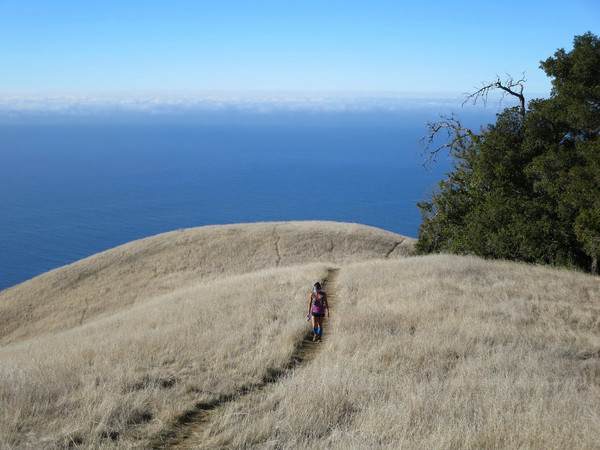
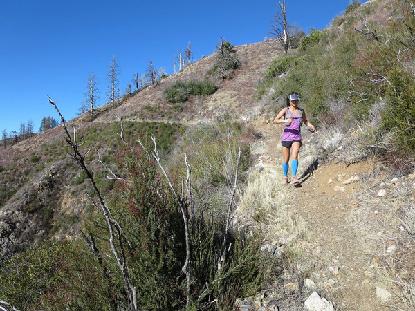
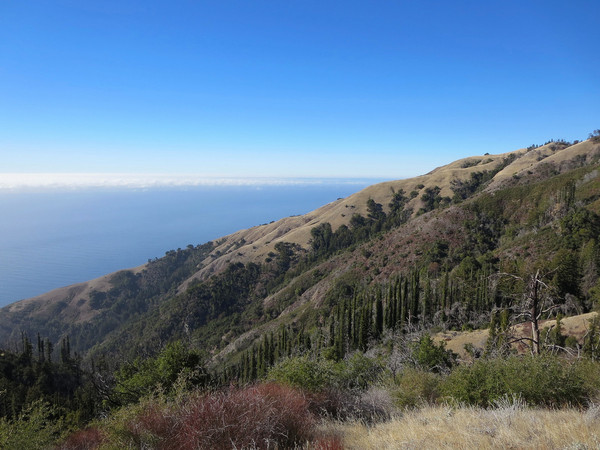
The Boronda-De Angulo Loop is a classic route of Big Sur. I like to describe Boronda Ridge as Stone Ridge’s little sister. Similar to Stone, Boronda is a prominent grassy ridge that rises steeply from the ocean with magnificent vistas of the Pacific Ocean and surrounding terrain. While Stone Ridge tops out at over 4,800 ft at the summit of Twin Peak, Boronda ridge reaches just over 3,000 feet at the summit of Timber Top. Boronda packs nearly as much punch as Stone Ridge in terms of rate of elevation gain per mile. The distance from the ocean to Twin Peak via Stone is around 5.5 miles with 5,000 ft of elevation gain while Boronda is only 3 miles with over 2,500 feet of gain. Despite its lower vertical, Boronda Ridge rises more steeply immediately from the ocean with truly impressive relief on the lower part of the ridge. From a vista at 1,500 feet above sea level, the topography is so steep that it’s almost as if you could dive into the ocean! The amazing views on Boronda are virtually non-stop owing to the fact that the ridge crest is almost entirely devoid of vegetation other than grass. The ridge culminates in an elegant arm at the upper part of the ridge, the highlight of the trail in my opinion. This photogenic rounded arm is separated by deep canyons of oak and redwood with the blue waters of the Pacific Ocean shimmering below. It’s a remarkable sight and now one of my favorite spots along the Big Sur Coast. 

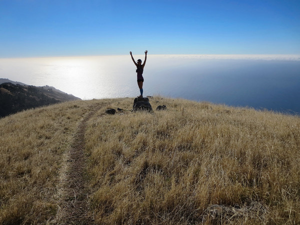
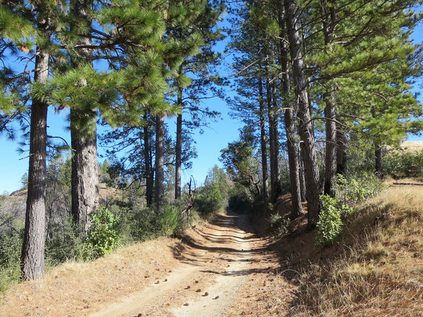
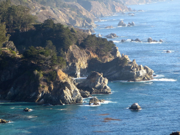
Beyond the elegant arm, a short traverse and final climb brought us to the summit of Timber Top. The view from Timber Top is gorgeous and worth spending some time to enjoy. From Timber Top, we took the access road down to the Coast Ridge Road, which clings to the crest of the ridge with more spectacular vistas towards Big Sur amid the many grassy ridge lines that characterize this beautiful section of Coast Ridge. Heading north along the Coast Ridge Road from the junction withTimber Top is also beautiful with more open grassy hillsides and excellent views to Ventana Double Cone and the Big Sur River drainage. After exploring to the north we retraced our steps and took the Coast Ridge Road south to the De Angulo trail. The De Angulo Trail starts by traversing a steep hillside and then descends the spine of Partington Ridge with a jumble of loose rocks. The trail then turns off the spine of Partington Ridge and commences a series of steep switchbacks down the hillside with very loose, poorly defined, and sharply angled tread. Suffice it to say this stretch is not very runnable, but at least it has been recently brushed. The De Angulo Trail finally pops out on an old fire road which is taken down to Highway 1. This fire road provides very nice views of Boronda Ridge and north along the rugged Big Sur Coast. Once at the highway, a 1.5 mile run brought us back to the Boronda trailhead. While the traffic can be annoying, there are enough turnouts and awesome views to make it worthwhile to complete the loop. The base Boronda-De Angulo Loop is a little over 10 miles but extensions along the Coast Ridge Road are worthwhile. The route is also near McWay Falls at Julia Pfieffer Burns State Park. We visited this iconic destination of Big Sur in nearly ideal afternoon light and I’ve posted those photos at the end of this post. Strava route here. 


What a beautiful place to run! This is definitely on my list of places to visit and run in. Thanks for sharing.
Beautiful pictures! Do you by any chance have suggestions for wilderness camping in the big sur/cone peak area?
Thanks Julia!
The Cone Peak area probably has the best wilderness camps. Goat Camp on the Stone Ridge Trail is very nice. A flowing stream is located nearby. Trail Spring camp on the backside of Cone Peak is pleasant with rare Santa Lucia Fir forest, but the spring itself is just a drip in this drought. Vicente Flat camp is probably the most popular (redwoods) and has good flowing water upstream of the camp along the trail (the stream bed is dry at camp, but flowing strong up the hill).
For other Big Sur areas, the Ventana Camp on the Big Sur River is nice (redwoods, beautiful river). Sykes Hot Springs is a bit of a zoo, but lots of camp spots there. Pico Blanco camp has a waterfall and natural soak pool along the S. Fork Little Sur River.
How do you find the De Angulo trail head? I went south on Coast Ridge Road from Timber Top a few times, but never saw it. Thank you for the great blog!
The ridge culminates in an elegant arm at the upper part of the ridge. Is that at top of Boronda or Timber top? Never been there please clarify.
This is an old post, so may not get a reply, but is it possible to camp on this trail?