

Grand Ventana Traverse – Chews Ridge to Molera Beach via the Ventana Cones:
April 12, 2019; James Bueno, Toshi Hosaka, Leor Pantilat, Sean Reedy
Nestled deep within the 240,000 acre Ventana Wilderness is the most rugged coastal terrain in the contiguous United States. The peaks and points of interest within this region have been the source of many dreams and adventures over the years. A natural culmination of all of these experiences was the Grand Ventana Traverse, an aesthetic point-to-point trans Santa Lucia route that crosses the northern part of the mountain range from Chews Ridge to Molera Beach at Andrew Molera State Park. The route verified at around 32 miles with over 10,000 feet of elevation gain and 15,000 feet of elevation loss, but the stats do not tell the full story of what is involved. While over half of the mileage is on trails, the off-trail portion passes through arduous and unforgiving terrain requiring a panoply of Ventana skills: route-finding, traversing loose talus, rock scrambling and bushwhacking through thick coastal chaparral. Primary summits include South Ventana Cone, Ventana Cone, Ventana Double Cone, the Window, Kandlbinder Peak, Cabezo Prieto and Post Summit. I had personally experienced all of the route on separate trips over the years so none of the terrain was new to me, but putting all the pieces together in a single day was rewarding. Full photo album here.

Note: Prior experience with off-trail travel in the Ventana Wilderness is extremely helpful before attempting any off-trail portion of this route since the Ventana backcountry posses its own unique set of challenges. Moreover, advanced navigation skills and comfort on very steep, rugged terrain with scrambling are essential for any explorations into Ventana Creek Cirque (aka the Drain), which is included on this route.

History: Flyin’ Brian Robinson introduced me to Ventana Double Cone (VDC) in December 2013 and I was hooked on the possibilities of adventure in this wild terrain. The trip to VDC was shortly followed by a loop including Kandlbinder and the Window in February 2014. A plunge into “The Drain” was next in May 2014. A year later in April 2015 the “Triple Crown” was completed, a route named by Bob Burd that traverses the ridge connecting the three Ventana Cones: South Ventana Cone, Ventana Cone and Ventana Double Cone. In the next years, I completed innovative routes including trips to Ventana Cone, the Ventana Spires, Ventana Creek, Ventana Mesa Creek and Lion Rock. The Soberanes Fire and subsequent wilderness closure put a halt to these adventures for over a year. However, the fire also provided an opportunity.

Opportunity from Fire: Gazing at Ventana Double Cone and Kandlbinder from the west at Post Summit and Cabezo Prieto, they always seemed relatively close. A moderate ridge separates the South Fork of the Little Sur River from the Big Sur River drainage and provides a natural connecting ramp between Cabezo Prieto and Kandlbinder. Indeed the distance is only 3 miles from Cabezo Prieto’s summit to Kandlbinder, but vast stretches of nearly impenetrable brush were more than enough to dissuade me from attempting this route as a day trip. When the Soberanes Fire roared over the ridge burning hot it changed the equation. It appeared the fire had cleared out many years of brush accumulation and caused me to rethink a potential route to Kandlbinder from the west.

The Idea: Not knowing exactly what to expect after the fire, I was very pleased with what we found in January 2018 and an efficient route to Kandlbinder was uncovered! This was followed up with a successful 14 hour out-and-back to Ventana Double Cone via the Drain and Cabezo Prieto in April 2018. With increasing confidence in the uncovered route and multiple experiences negotiating the rugged chutes into and out of the Drain, I contemplated a “grand” single-day traverse combining the Triple Crown, Drain, Window, Kandlbinder, Cabezo Prieto and East Molera Ridge to the ocean. To my knowledge, nobody had ever combined all of these points in a single trip, let alone in a single day. It seemed like my experiences in the Ventana over the years were building up to such an ambitious idea, but it only presented itself after the Soberanes Fire fortuitously cleared some brush.

Heat and Water: While I conceived the idea in late Spring of 2018, the interior of the Ventana is not a friendly environment for adventure after mid-May with relentless heat, biting flies and rattlesnakes complicating matters. It should be noted that water is extremely scarce on the route as it largely sticks to high, exposed ridges. In fact the only accessible water on-route is the Carmel River headwaters along the Pine Ridge Trail early on, Pine Ridge Camp and the Drain. If needed, one can descend about 0.25 out-of-the-way to the South Fork Little Sur River between Kandlbinder and Cabezo Prieto. Any other water source would require a substantial diversion in terms of effort. There is virtually no shade along the ridges and they are totally exposed. Consequently, even moderate heat into the 70s feels a lot worse on the ridge. Add in the swarms of flies and it can be miserable.

Picking a Day: Not looking for a heat sufferfest, I decided that the adventure would have to wait until the next season when temperatures cooled. However, from December through mid March the days seemed too short to bite off on the entire traverse as I estimated it would take at least 15 hours and there were some uncertainties in how long some sections would take. It’s always a good idea to allocate enough time to finish the off-trail portions in daylight. The ideal time would therefore be a cool day after daylight savings time begins in mid March. Such a day presented itself on April 12th as a cold front passed through the prior evening resulting in cool and breezy conditions throughout the day. A few morning clouds would give way to clear and crisp conditions, which was as good a forecast as one could ask for.

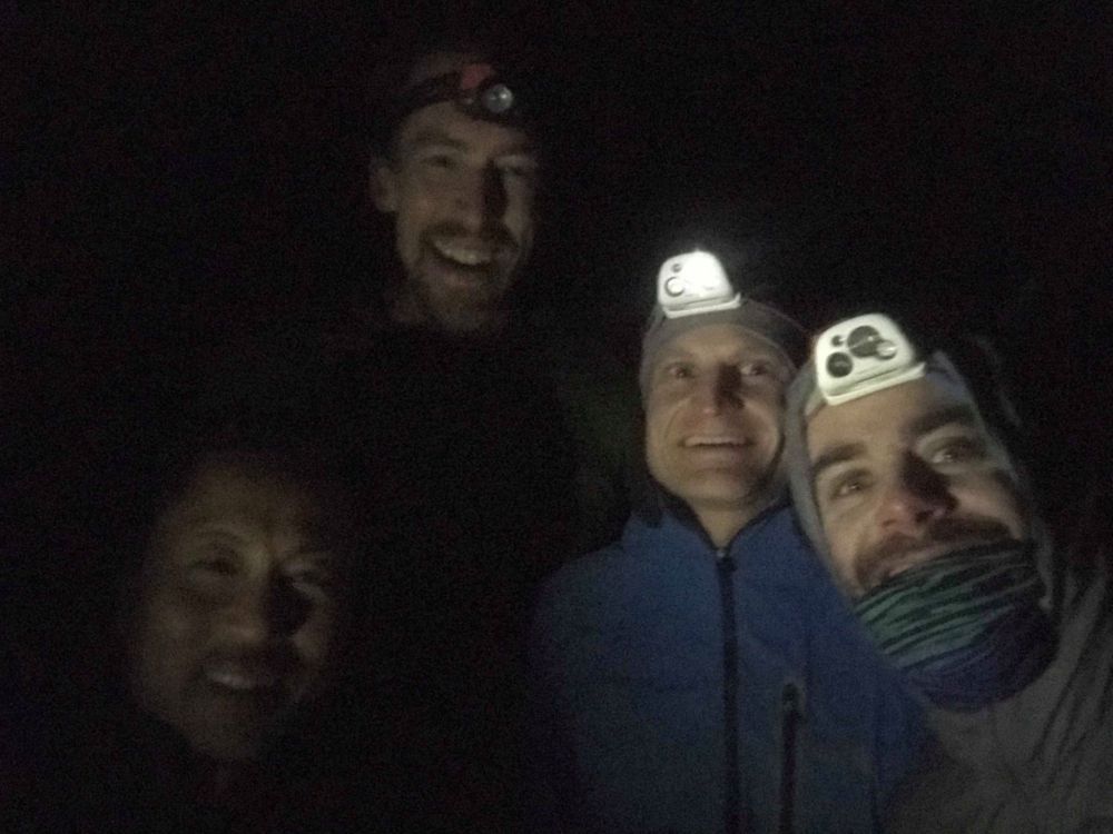
Completing the route was only part of the adventure. With a good forecast and extensive planning completed, an “all-star” team of Ventana adventurers, including James Bueno, Toshi Hosaka, Sean Reedy, and myself were assembled at Chews Ridge at 4 am on April 12th eager to go. Days of experience adventuring through this terrain and many hours of additional planning resulted in excellent execution and enjoyment throughout the route. The process of dialing in the micro-navigation through prior trips and extensive research was part of the fun and the journey. The sense of satisfaction in completing the traverse would not be the same if I simply followed somebody else’s directions or a GPS track. It is for this reason that I am not sharing too much detail here. As opportunities to find a real adventure are becoming scare in today’s hyper connected world, it is my belief that preserving the sense of adventure in the few places that remain relatively unknown and mysterious is vital.

Perhaps the only inconvenience on the route was the low clouds that hung over the mountains overnight resulted in wet chaparral. While the clouds dissipated as we were beginning, the brush stayed wet in the pre-dawn hours resulting in some wet and cold gloves and fingers. The brush would dry and the fingers would warm quickly after sunrise and the remainder of the day was perfect weather for the traverse. We made extended stops at all the summits and paused for viewpoints between the summits. Late afternoon light from the Window pinnacle and Kandlbinder was stunning and the off-trail portions were completed before sunset as I had hoped. In all, the adventure from car-to-car (including out-and-backs to Chews Ridge and Molera Beach) took 17 hours and 50 minutes.

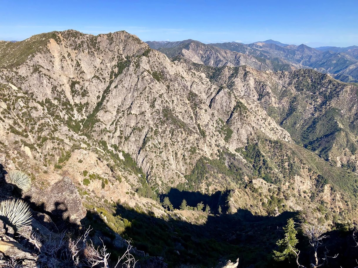
What makes the route “grand”? This will always be a subjective analysis in the eye of the beholder, but for me it contains all of the highlights of this rugged, trailess region in an aesthetic point-to-point. From Chews Ridge all the way to Andrew Molera State Park the scenery is outstanding with no filler miles. There are over a dozen unofficial and official peaks and important points of interest along the way, each having their own rewards. The route includes the high and extremely remote ridge between South Ventana Cone and Ventana Double Cone with its sweeping views and remote peaks including Lion Rock, Ventana Knob and the Ventana Spires. After VDC, the route descends into the depths of the Drain, a spectacular cirque surrounded by towering cliffs and hanging Santa Lucia Firs. In my opinion this cirque is the heart of the Ventana. A steep ascent out of the Drain returns one to the ridge crest at the Window, namesake of the Ventana Wilderness and site of much history and lore. Breathtaking views await at the pinnacle above the Window and also at Kandlbinder, the opposite side of the cirque from Ventana Double Cone. A spectacular ridge traverse leads from Kandlbinder to Mulberger Dome (aka Ventana Dome). The awesome scenery continues all the way to Cabezo Prieto where one rejoins a trail. After one last peak at Post Summit, the route descends down East Molera Ridge, a classic Big Sur grassy ridge. The route concludes by extending the trip one mile beyond Highway 1 to the Pacific Ocean Andrew Molera Beach. With its blue water visibible for most of the route, ending the journey with a touch of the Pacific Ocean is most fitting.

The Future: It’s hard to imagine a more aesthetic single day route through this region at the moment, but I’m sure with time, creativity and desire for new exploration additional worthwhile adventures will emerge. What we know for certain is conditions in the Ventana (particularly brush) are constantly changing. The Soberanes fire fortuitously cleared out some brush-choked sections, but as the years pass from that fire the brush is growing back vigorously in spots. Without some route maintenance it’s easy to imagine the ridge between Kandlbinder and Cabezo Prieto returning to its prior brushy form within a couple years. In fact, the worst brush encountered was between the Ventana Spires and Ventana Double Cone which had not burned in the fire. What was once low to medium height manzanita and scrub oak three years ago has now grown over head high and has become quite thick. This short but intense stretch of bushwhacking was a reminder of what was once more prevalent along the route prior to the Soberanes fire and what will become of more of the route in the future given an extended stretch without fire.


Summits and Points of Interest on the Grand Ventana Traverse:
Green = officially named; Blue = unofficial but universally recognized name; Other = unofficial with no universally recognized name (including the name I use)
- Chews Ridge: 5,045 ft
- South Ventana Cone: 4,965 ft
- Peak 4455 (Blue Peak)
- Ventana Cone: 4,727 ft
- Peak 4387 (Lion Rock)
- Peak 4200+ (Ventana Knob)
- Peak 4450+ (Ventana Spires)
- Ventana Double Cone: 4853 ft
- The Window: ~4,250 ft
- Window Pinnacle Vista: ~4,350 ft
- Peak 4653 (Kandlbinder Peak)
- Mulberger Dome (Ventana Dome): ~4,250 ft
- Cabezo Prieto: ~3,550 ft
- Post Summit: 3,455 ft


Leor, your trips are always an inspiration. I’ve been hiking in the Ventanas for years, but would like to improve my gear to better deal with the tough conditions you describe. Could you please share with me your team’s choices in clothing and equipment that get you through the tough Ventana terrain with protection as well as speed? I am also interested in your preferences in food and other “supplements” such as, perhaps, consuming electrolites in solid form or adding them to drinking water.
Cheers,
Gene
Pacific Grove
Hi Gene, sorry for the delayed response! For this trip I wore long tights and long shirt (Patagonia Capilene). I also wore gloves. My pack is the Ultimate Direction Mountain Vest. Others had different packs and wore hiking pants (vs tights). For clothing I look for something that will keep my skin protected from brush but is light, breathable and flexible. I usually use old clothing that I don’t mind getting torn up. For food it’s easier to get by on a day trip (vs. overnight) and my selection currently includes Clif Nut Butter bars, Trail Nuggets Pro (at Trader Joe’s), jerky or meat sticks, Gu, and Clif Shot blocks. If it’s a hot day I’ll use SaltStick electrolyte capsules or Gu Hydration Tabs.
PS: In regards to clothing, I’m interested in specific brands and models.
Thanks,
Gene
Great job. Cheers and congrats!
I know and love that terrain but lordy, you guys are CRAZY.