
The Cirque Crest is located between the Middle and South Forks of the Kings River which form the heart of Kings Canyon National Park. Naturally, the terrain is extremely rugged and the scenery is magnificent. The Cirque Crest is one of the most remote areas in all of the High Sierra. Typical access from the west is via Road’s End and from the east via Taboose Pass. Both options entail lots of trail miles and lots of elevation gain followed by substantial off-trail travel making this region particularly suitable for adventure running. For this exploration into the Cirque Crest region I decided to access from the west side via Road’s End and encircle the western portion of the Cirque Crest including Windy Point and Marion Peak. The route came in over 50 miles with over 15,000 feet of gain and required nearly 19 hours, but it was well worth the effort and I look forward to returning to this rugged and wild region for further exploration. GPS route here.

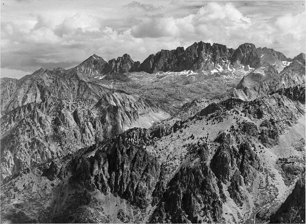
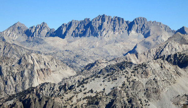
 Windy Point is a grand view of the Middle Fork Kings Canyon, one of the most rugged canyons in the world, including Le Conte Canyon, Goddard Creek Canyon and Tehipite Valley, Yosemite Valley’s smaller sibling. The deep chasm of Middle Fork Kings Canyon is surrounded by towering peaks including the fabled Palisades to the east, the Goddard region to the north, and the Cirque Crest to the south. Taken together, this view encompasses the most rugged and wild region of the High Sierra. Windy Point is located about one mile off the Sierra High Route at the end of Windy Ridge that protrudes into the Middle Fork Kings Canyon drainage. For those on the Sierra High Route journey it’s well worth the extra effort to reach this fantastic vantage, a classic view of the High Sierra. Windy Point is also the location of a series of famous Ansel Adams photos and I was privileged to see the same view as Ansel minus the clouds and snow patches in his photos. A comparison of one of Ansel’s photo to mine is provided below.

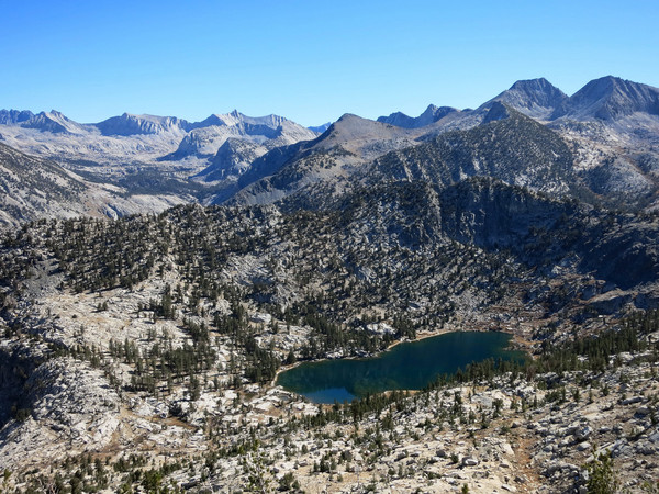
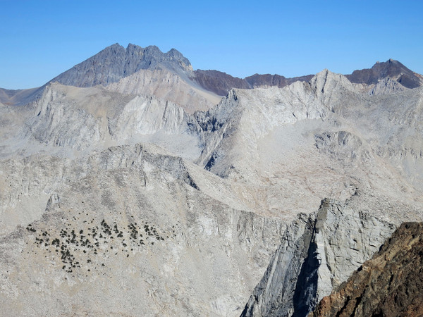
After a long time gazing in awe at the stupdenous view from Windy Point, I retraced my steps to the Sierra High Route, passing near Lake 10,236 which has a spectacular backdrop of peaks and canyons behind its blue waters. I continued along the Sierra High Route over Gray Pass to a beautiful basin below the Cirque Crest which gradually ascends to White Pass. At White Pass, I left the Sierra High Route and proceeded up the northwest ridge of Marion Peak. This ridge is mainly a class 2 scramble with a some class 3 in spots but most of the exposure can be avoided. It’s a fun route in an amazing setting with excellent views into Lake Basin. The summit of Marion Peak has a stellar 360 degree view with a sea of peaks all around including the Goddard Divide, the Palisades and the Cirque Crest. To the south, Arrow Peak and Arrow Ridge are prominent and Taboose Pass seems close at hand (but in reality it’s quite a trek).

I descended the steep and very loose southeast chute of Marion Peak into a small basin with a couple alpine lakes and then climbed a talus gully toward a ridge spur off the Cirque Crest. Crossing over this ridge entails some class 3 scrambling and then more easy cros country terrain through a remote basin with a few alpine lakes and excellent views to Arrow Peak and Arrow Ridge. I was hoping to climb State Peak as part of the loop, but when I reached a small col northeast of the mountain it became apparent that to get from my location to State Peak I would need to engage in a time-consuming and exposed ridge traverse. Since my legs were growing tired and sunset was approaching I decided to save State Peak for next time, which proved to be a good decision as I would not have made it back to the trail before dark. Looking over the maps in hindsight I might have been able to get to State Peak via a different approach without this ridge traverse, which is something to keep in mind for next time. This is an area I’ve been wanting to visit for awhile so it was great to finally get out there and I look forward to exploring Lake Basin in the future including Marion Lake. Actual mileage was ~51 miles. GPS route here.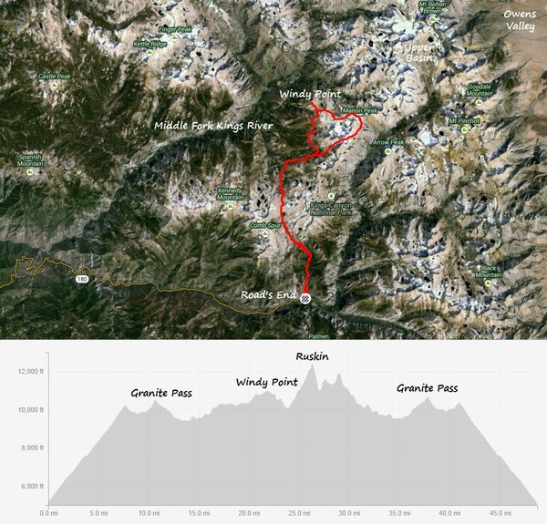


Great Shots! Wish I had been there as well.