
The Cabezo Molera Loop is a stunning route and among the finest adventure runs in all of the Big Sur Coast and Ventana Wilderness. The loop includes an aesthetic mixture of excellent views atop a rugged ridgeline followed by excellent coastal vistas and a beautiful beach. The route comes in around 26 miles with 6,700 ft of elevation gain and some off trail travel makes it a challenging marathon route. While the loop can be done in either direction, the preferred direction is as described, which starts with East Molera Ridge and finishes with the coastal section in Andrew Molera State Park. This direction optimizes photography which includes morning light on East Molera Ridge, midday light on Ventana Double Cone from Mount Manuel, and afternoon light on the coast at Andrew Molera State Park. The route begins at Andrew Molera State Park and ascends up to East Molera Ridge, one of my favorite grassy ridges in Big Sur. The last time I was on East Molera Ridge it was bursting with wildflowers and vibrant green grass. While the meadows were golden this time, it was still an amazing trip up the ridge and to Post Summit with the white limestone apron of Pico Blanco commanding attention the entire way. Strava route here.

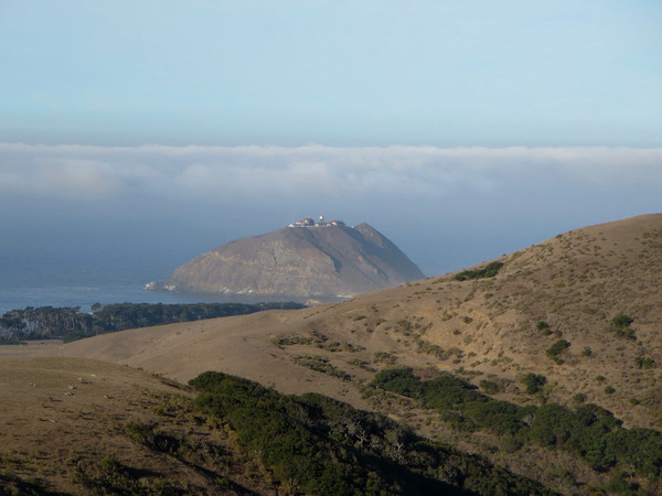
Beyond Post Summit the section of the traverse to Mount Manuel was all new terrain for me and it far exceeded expectations. The route sticks to the ridge crest and therefore provides amazing views down to the South Fork Little Sur River on the east side and down the rugged Juan Higuera Creek canyon on the west side. Ascending up to the high point of Cabezo Prieto, the view of Pico Blanco’s limestone face is as striking as anywhere. There were even some Santa Lucia Firs growing on this cliffy slope that proved particularly photogenic with a backdrop of a low marine layer off the coast. Beyond Cabezo Prieto, we found the use path to Mount Manuel reasonably easy to follow through the brush, ultimately emerging at a series of lovely viewpoints on Mount Manuel with stellar views to Ventana Double Cone, the interior Ventana Wilderness, and the Big Sur Coast. 


My favorite viewpoint was from a prominent knoll on the way down from Mount Manuel off slightly off the trail, a viewpoint that I call “Manuel Vista.” This point features a remarkable, unobstructed 360 degree view from Ventana Double Cone to the entire Big Sur River drainage to Point Sur. Contuing the descent off Mount Manuel the trail is in pretty rough shape in spots in the upper elevations but becomes better in the last couple miles into Pfeiffer Big Sur State Park. Descending to the valley bottom by the Big Sur River suddenly transitioned to a completely different ecosystem with redwoods instead of the parched chaparral slopes on Mount Manuel. After a break at the State Park near the Big Sur River we continued along a couple miles of road on Hwy 1 to a back entrance into Andrew Molera State Park Trails. This back entrance is a little tricky to find. Just past the River Inn is a gated bridge across the Big Sur River that contains a window for pedestrian passage. Just after the bridge, turn right onto single track for around 0.3 miles before coming to a junction. To the left is the start of the South Boundary Trail (as of January 2014 the trail sign was on the ground). The path ascends through redwoods and oak woodlands to great views of Pico Blanco, Post Summit, Cabezo Prieto and Mount Manuel. Ascending higher up on the Ridge Trail we reached the a point on Pfieffer Ridge with views into the recent devastation caused by the Pfieffer Fire (Andrew Molera State Park and its trails were not impacted by the fire). From the viewpoint, we headed down Panoramic Trail and then Bluffs Trail to Molera Beach with with some awesome afternoon light on the coast. Finishing along the coast with a cool ocean breeze served as a perfect way to finish a great run and complete the loop. Strava route here. 


Great stuff Leor…beautiful! That looks like it would be cookin’ in the Summer months.