Photo album here.
The Onion Loop provides an excellent sampling of the high country above Onion Valley in a complete loop with minimal repetition. The route includes excellent views throughout, fun scrambling, several alpine lakes and the three primary summits that reside along the Sierra Crest in the region: Dragon Peak, Mount Gould and University Peak. Onion Valley and Kearsarge Pass are a major gateway to the John Muir Wilderness and Kings Canyon National Park so the main trail up to the pass and adjacent lakes are quite popular and somewhat crowded. However, this route eschews the main trail for all but a mile and entails a considerable amount of scrambling and off-trail travel with grand vistas and spectacular scenery. GPS route here.


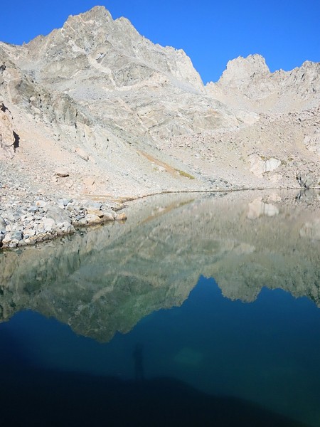
 The first part of the route ascends the steep trail to the Golden Trout Lakes where Dragon Peak, the first summit objective, towers above the pristine alpine lakes. Dragon Peak is an outsanding summit with a fun class 3 scramble. In particular, the final summit block includes some exposure and a traverse across a narrow ledge. The views from Dragon Peak are stellar and include the deep blue Dragon Lake immediately below and the entire Rae Lakes Basin. Mount Clarence King and Mount Cotter show there impressive east faces and to the south the view includes layers upon layers of peaks including Mount Rixford, the Kings-Kern Divide and the Great Western Divide. It’s a fabulous spot and the author’s favorite summit of the three on this loop; well worth enjoying the summit perch!

 After descending Dragon Peak, the traverse to Mount Gould goes as entirely class 2 by staying on the west side of the crest or class 3 if one chooses to stay on the crest proper. Mount Gould is a large massif with a broad plateau. The actual summit (by a few feet) is on the SE side of the massif but there is another high point on the northwest end of the plateau that is worthy of the extra effort for a grand vista of the Rae Lakes basin and down the south fork Woods Creek drainage. This subsidiary summit on the NW end of the plateau contains some measuring equipment and transmitters which I would rather not be there, but it doesn’t distract too much from the amazing vista. While the NW summit of Gould has the best view looking north, the SE (actual) summit has the best view looking south including the Kearsage Pinnacles and Lakes, Kings-Kern Divide and Great Western Divide. The actual summit of Gould is a fairly small pinnacle with a few class 3 moves, most easily done when approaching from the west. The author’s favorite view from this perch was East Vidette with its classic triangular shape rising above the Kearsarge Pinnacles with Deerhorn Mountain and the Great Western Divide forming the background (pictured in the black & white photo above). From Mount Gould traverse a couple ribs to a broad sandy slope above Kearsarge Pass where the sand enables a remarkably efficient plunge step down to the pass. From Kearsarge Pass, the next objective is the north face of University Peak. Descend a short distance on the Kearsarge Pass trail to a bench above Heart Lake and then take a use path to the lake. From Heart Lake, traverse cross country over some talus and alp pine slopes to beautiful Bench Lake.
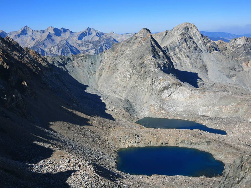
 Aptly-named Bench Lake sits at the foot of University Peak in a lovely setting of granite and pines. From Bench Lake, the most efficient route to University Peak’s north face is to take the solid slabs starting on the east side of Bench Lake. The slabs transition to more talus and large block as one ascends. One can keep most of the ascent at class 2 or opt to tackle some class 3 to keep things as direct as possible. Near the top the terrain grows steeper but the climbing is still largely class 3 with some easy class 3. The final traverse to the summit is on a surprisingly broad ledge on the north side of the ridge with a few more scramble moves near the top. Overall, it seems the north face of University Peak gets a reputation as a harder scramble than it actually is. Most of the route is a class 2 slog and the scramble portions have little exposure. The views from the route overlooking the chain of lakes between Kearsarge Pass and Onion Valley is fantastic. Moreover, the view from the summit into Center Basin, Forester Pass and Mount Stanford are excellent. From the summit of University Peak traverse sandy slopes on the west side of the ridge to either University Pass or a shortcut chute north of University Pass. Here is where the route becomes quite tedious with a lot of boulder hoping that is unavoidable in the glacial moraine area. As one travels down to Robinson Lake, there is still quite a bit of talus, but also sections of easier terrain, and the last few hundred feet down to Robinson Lake are on slabs and pine forest. From Robinson Lake it’s a fairly short trip down the trail back to Onion Valley.