
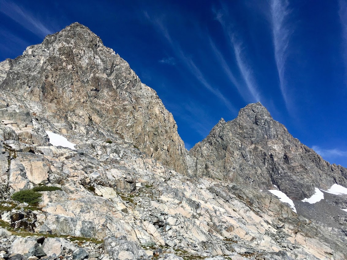
Mount Ritter is the centerpiece peak of the Ansel Adams Wilderness, and at 13,150 ft, it’s also the highest peak in the region with a commanding view of the surrounding landscape. Together with its close neighbor Mount Banner, the two peaks are visible from virtually anywhere in the Ansel Adams Wilderness and are a familiar sight when looking north from high points as far south as Sequoia National Park. I’m a frequent visitor to the Ansel Adams Wilderness, but one of my favorite spots in the region is the seldom visited north side of Mount Ritter which contains a chain of spectacular glacial lakes set in a wild setting of dark rocks and spires. The following description details a loop up and over Mount Ritter into the Ritter Lakes basin. Along the way you get some spectacular scenery at iconic spots like Shadow Lake, Lake Ediza and Thousand Island Lake. Photo Album here.


The standard route up Mount Ritter is known as the southeast glacier route. Unfortunately, “glacier” may not longer be an appropriate name for the route as climate change has caused the glacial ice to retreat into the shadiest, steepest part of the cirque such that on a dry year one can likely avoid snow and ice entirely. If earlier in the season or during a wet year where firm neve forms later in the season consider bringing crampons and ice axe. Starting at Agnew Meadows, descend to the River Trail and then turn right on the Shadow Lake Trail. Beyond Shadow Lake, continue to gorgeous Lake Ediza with its magnificent views of the Minarets. If heading for Ritter, the quickest way around Lake Ediza is on its north side. After crossing a small talus field that reaches the water, a use path becomes more defined and heads up to the beautiful alpland meadows beneath Ritter and Banner. Mountain hemlock forest transitions to open meadows with streams cascading down the slope. Mount Ritter and Banner Peak tower over the landscape. At a large tarn, the route for the SE Glacier turns left and utilizes ledges and gullies to climb through a broken cliff band to access convenient granite slabs above. Climb the slabs to the start of the snow fields and ascend into the cirque containing the remnants of the glacier. Once in the cirque, one can climb a steep and somewhat loose chute known as the Secor chute which provides a direct route to slopes above or take a more circuitous but less steep route by continuing up the snow in the cirque and then circling back on talus. The final few hundred feet of climbing to the summit is a straightforward talus hop. The summit of Mount Ritter has a fantastic view including the Ritter Lakes and Mount Catherine immediately below, Mount Lyell and Rodgers Peak to the north, and the Minarets to the south. Immediately to the northeast is Banner Peak and Garnet Lake. Farther afield, Mammoth Mountain, the Silver Divide, Mono Divide and Red Slate Mountain are visible.


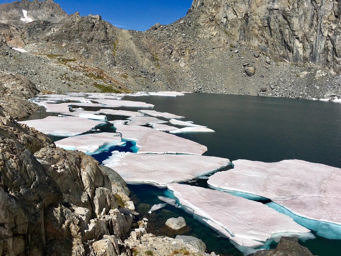
To access the Ritter Lakes from Mount Ritter descend the NW slope route by descending talus and scree from the summit to a broad saddle south of the summit. Cross over the saddle and traverse south to a broad gully descending the northwest slope of the mountain. Descend this gully until the the terrain starts to transition from loose scree to solid rock and cliffs. At this point, traverse skiers right to a broad slope. Steep snow patches may remain on this slope until late in the season. Descend this slope and then angle down to the highest of the Ritter Lakes. Upstream of this lake, a larger glacier occupies the northern slopes of “Neglected Peak,” a prominent point along the South and SW ridges of Mount Ritter. This glacier supplies minerals to snow and ice melt creating a wonderful emerald color in the highest Ritter Lake. At least three other large lakes can be found lower down, each nestled among cliffs and slabs. The high lakes often hold onto ice late in the season and ice bergs were observed in September this year. After traversing the lakes a pass leads to the south side of Lake Catherine. Round Lake Catherine on its west side to reach North Glacier Pass and the straightforward descent to Thousand Island Lake. Complete the loop by taking the River Trail or PCT back to Agnew Meadows.


You should put a caption on each picture so we know what we are looking at! Beautiful pics but?